Forecast verification of ¨day 1 team¨

showforecast

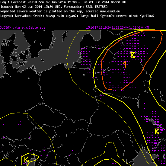
The day began with the verification session of yesterdays ¨day1-forecast¨. As it can be seen on the attached figure, Warsaw domain team managed to forecast lightning probability areas quite well. Highest activity of thunderstorms was observed along the cold front in central part of the Ukraine and parts of Belarus, Latvia and Russia where team issued level 1 threat.

Now, teams changed their tasks and work on day 1 and day 2 forecasts.

We are also looking forward to check the forecast of yesterdays day 2 team tomorrow morning. They issued level 1 for parts of eastern Europe. Will severe weather occur in that area? We will see. showforecast (1)

Share

The first day at the ESSL Testbed 2014

10

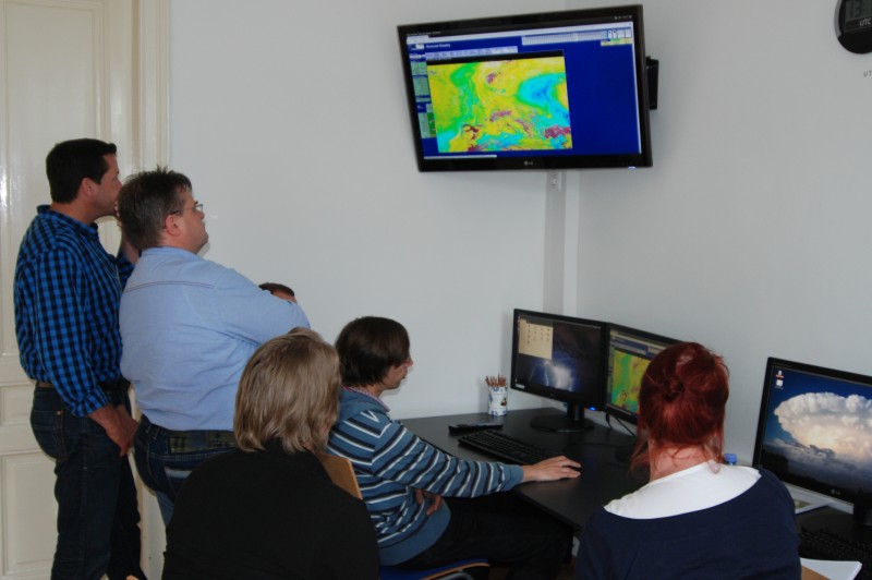
In this first week participants from 7 different countries are on site (Austria, Finland, Germany, The Netherlands, Latvia, Switzerland and Poland).

In the morning Pieter Gronemeijer discussed all the available products in the Testbed display and outlined new nowcasting and NWP tools at this Testbed edition. A “roaming sounding” tool allows for model sounding analyses “on the fly”.

Like last year, with support of EUMETCAL remote participants are able to attend the Testbed’s online weather briefings and expert presentations. The first lecture was given by Prof. David Schulz from Manchester University: “Scientific Forecasting: How to Be a Better Forecaster?”.

Then the daily weather briefing was conducted by Georg Pistotnik. The atmosphere did not know any mercy and confronted the participants of the first Testbed week with a challenging start: no obvious hot spot for severe storms. However, participants managed to find places where deep moist convection is likely to occur. A level 1 was issued! How good were these predictions? It will turn out tomorrow in the verification session.

First interesting day in ESSL Science and Training Centre ended at 17:30. In the evening participants were given the opportunity to discover Wiener Neustadt on the guided tour.

Share

The Testbed 2013 is over… but…

Today (Fri 26 July 2013), the last of the four Testbed weeks has ended. The current severe weather episode over France, the BeNeLux countries and Western Germany has made it a particularly exciting and intensive week, which is also the reason why there is no time for a longer blog entry today.

However, we promise to publish a wrap-up of the meteorological developments and our forecast activities for the high-impact severe weather situations that occur(red) yesterday (Thu 25 July 2013) and probably today (Fri 26 July 2013) and tomorrow (Sat 27 July 2013) as soon as possible, hopefully in the course of next week. As a teaser: the highest threat level 3 was issued for parts of France for today and tomorrow, meaning a greater than 15% chance of extremely severe weather (hail >5 cm, wind gusts >32 m/s and/or tornadoes rated F2 or stronger) within a radius of 40 km around a given point. Stay tuned!

Meanwhile, we thank all participants for four wonderful and productive weeks! We hope all of you enjoyed the time in Wiener Neustadt as much as we, the ESSL staff, did!

Share

Thu 25 July 2013: drum roll and fanfares!

The models seem determined that we are heading towards an exceptional severe weather outbreak in the Western half of Europe in the next couple of days. Forecasting an approaching high-impact situation gets more and more exciting, but also more challenging.

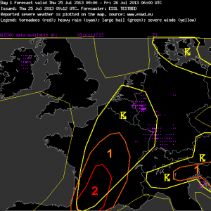
Fig. 1 presents the day 1 forecast issued today (Thu 25 July 2013). The group on duty was working so hard that they ran out of time to issue an explanatory text along with it. 😉 However, a brief reasoning can be presented here, along with a handful of model maps. While the zone of widespread but weakly organized thunderstorms which has concerned us this week so far is slowly leaving the Paris domain to the East (a level 1 area for pulse storms with a main threat of excessive rain over N Italy and Slovenia is its remnant), the coming period of strongly organized convection is expected to be kick-started over SW France today in the evening.

Fig. 1: Day 1 forecast issued today, Thu 25 July 2013.

Fig. 1: Day 1 forecast issued today, Thu 25 July 2013.

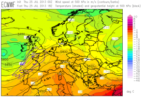
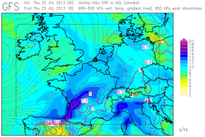
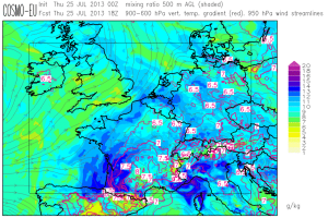
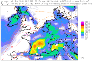
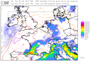
With the gradual eastward shift of the upper-level jet streak ahead of the Atlantic trough (Fig. 2), steep lapse rates from Iberia and rich low-level moisture accumulation along a convergence zone / sea breeze front are expected to coincide over SW France. This combination results in the first remarkable overlap of CAPE around 2000 J/kg and deep-layer shear between 15 and 20 m/s. Figures 3 and 4 show that GFS, ECMWF and COSMO-EU agree on this scenario despite their different model resolutions and the resulting different representation of the topography.

Fig. 2: ECMWF forecast for 500 hPa geopotential (black contour lines), temperature (color shading) and wind (barbs) for 18 UTC Thu 25 July 2013.

Fig. 2: ECMWF forecast for 500 hPa geopotential (black contour lines), temperature (colour shading) and wind (barbs) for 18 UTC Thu 25 July 2013.

Fig. 3a: GFS forecast for mid-level lapse rates (red contour lines, plotted above 6.5 K/km) and low-level moisture (colour shades) for 18 UTC Thu 25 July 2013.

Fig. 3b: As in Fig. 3a, but for ECMWF.

Fig. 3: GFS (top), ECMWF (center) and COSMO-EU (bottom) forecast for 18 UTC Thu 25 July 2013: mid-level lapse rates (red contour lines, plotted above 6.5 K/km) and low-level moisture.

Fig. 3c: As in Fig. 3a, but for COSMO-EU.

Fig. 4a: GFS forecast for CAPE (colour shades) and 0-6 km vertical wind shear (red contour lines) for 18 UTC Thu 25 July 2013.

Fig. 4b: as in Fig. 4a, but for ECMWF.

Fig. 4c: As in Fig. 4a, but for COSMO-EU.

The convergence of the low-level wind due to sea breezes and upslope flows is thought strong enough to spark first thunderstorms towards evening, which have good chances to turn into supercells with a threat of large hail, severe wind gusts and locally excessive precipitation. A level 2 was issued for these threats. Even an isolated tornado is not ruled out along the sea breeze front, though it was agreed that the 0-1 km wind shear is rather borderline. Later tonight, the forecast models largely agree on the evolution of an MCS which shall travel northward across France, which is why a level 1 was extended northward for severe wind gusts and excessive precipitation.

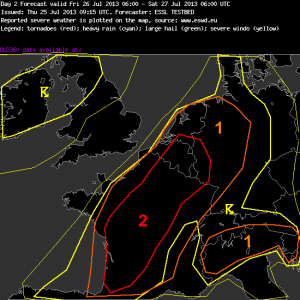
Tomorrow (Fri 26 July 2013) looks even more threatening over France, BeNelux and W Germany. The day 2 forecast for tomorrow is presented in full detail in Fig. 4.

Fig. 5: Day 2 forecast issued on Thu 25 July 2013, valid for Fri 26 July 2013.

Fig. 5: Day 2 forecast issued on Thu 25 July 2013, valid for Fri 26 July 2013.

—–

Day 2 Forecast

Valid: Fri 26 Jul 2013 06:00 to Sat 27 Jul 2013 06:00 UTC

Issued: Thu 25 Jul 2013 09:15

Forecaster: ESSL TESTBED

A level 1 and a level 2 were issued for large parts of France, Belgium, the Netherlands, Luxemburg and Germany mainly for large hail, severe wind gusts and to a lesser extent for tornadoes and excessive precipitation.

A level 1 was issued for N Italy mainly for large hail and excessive rainfall.

France, Benelux, Germany:

Warm air advection overspreads W and Central Europe from the Southwest. Steep lapse rates originating from Spain, the Pyrenees and the Alps will be advected into France and Germany. Very rich low-level moisture is expected to build up along a wavy front from W France into Benelux. This results in CAPE values around 2000 J/kg, locally even up to 3000 J/kg.

Deep-layer shear is between 20 and 25 m/s beneath the Southwesterly jet streak. Any storm that forms can quickly turn into a supercell. Later towards evening, growth into one or more large MCSes is also possible. Large hail and severe wind gusts pose the main threat. A tornado is not ruled out in areas where plentiful low-level moisture and enhanced 0-1 km shear overlap.

In the absence of synoptic-scale lift, local convergence zones in the low-level wind field act as possible triggers for convection. These include upslope winds (e.g. over the Pyrenees), sea breeze fronts (e.g. over W France) or outflow boundaries from overnight´s convection (mainly over N France, Belgium and W Germany). A level 2 area was drawn where our confidence in convective initiation is best. We left the Netherlands and NW Germany under a level 1, because residual cloudiness from overnight´s convection may limit diurnal heating.

N Italy:

Very rich low-level moisture again results in CAPE around 1000 J/kg. Vertical wind shear remains weak. Pulse storms are expected especially over the mountains with a threat of large hail and excessive rain.

—–

This afternoon, evaluation of the various tested products (NowcastMix, COSMO-DE ensemble prediction system and the Mesocyclone Detection Algorithm) is the primary task, since nowcasting is not so interesting yet. Until now (14 UTC), first weakly organized storms have only formed over parts of Germany and – completely off our radar this week – over parts of Ireland, Sweden and Russia.

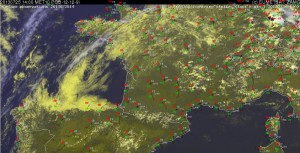
Fig. 6: Nowcast display at 1400 UTC Thu 25 July 2013: E-View satellite image, SYNOP reports and lightning detections within the last 15 minutes.

Fig. 6: Nowcast display at 1400 UTC Thu 25 July 2013: E-View satellite image, SYNOP reports and lightning detections within the last 15 minutes.

Everything is still quiet over the level 2 area, in line with our expected late initiation. Satellite imagery showed low stratus until 10 or 11 UTC, which then gave way to unimpeded insolation (Fig. 6). Dew points are around 20°C and temperatures well in excess of 30°C. We will continue to monitor when (and, as pessimists would say: if) storms will explode over the Pyrenees and SW France until we head out for our weekly joint dinner at 1630 UTC. I am sure some of us will even be intrigued enough to even resume monitoring between dinner and bedtime! 🙂

Share

Wed 24 July 2013: Germany is back in the game

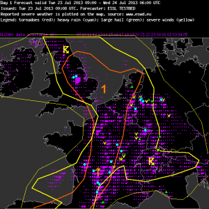
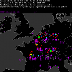
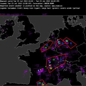
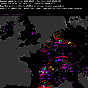
With the advance of a convergence zone and the associated increase of low-level moisture in the very warm air mass, a belt with daily widespread afternoon thunderstorms is slowly shifting eastward from Western into Central Europe these days. Due to still weak vertical wind shear, most of the storms continued to be poorly organized yesterday, but nonetheless they produced another round of excessive rain, large hail and severe downburst events scattered across France. The activity also started to spread into Western Germany, and the verification of yesterday’s day 1 forecast demonstrated that much of the severe weather events occurred further East than the issued level 1 areas (Fig. 1), similar to the day before. In the afternoon nowcasting session the same team struggled with the short-lived character and elusive nature of these pulse storms (Fig. 2).

Fig. 1: Verification of the day 1 forecast issued yesterday (Tue 23 July 2013).

Fig. 1: Verification of the day 1 forecast issued yesterday (Tue 23 July 2013).

Fig. 2a: Verification of the nowcast issued at 13 UTC Tue 23 July 2013, valid for the 13 to 15 UTC period.

Fig. 2b: Verification of the nowcast issued at 14 UTC Tue 23 July 2013, valid for the 14 to 16 UTC period.

Fig. 2c: Verification of the nowcast issued at 15 UTC Tue 23 July 2013, valid for 15 to 17 UTC period.

Now that Germany finally starts to get affected by thunderstorms again after several exceptionally calm weeks, more of our attention starts to shift back to those of our tested products which are confined to the German area, namely the high-resolution COSMO-DE ensemble prediction system, the NowcastMix product for an automatic warning guidance and the mesocyclone detection algorithm. All of them have been developed and provided by the German Weather Service (DWD).

Ongoing complaints that the forecast models tend to mis-estimate (and, in particular, undererstimate) the pulse storm activity of the current weather period led to a closer comparison of the CAPE and precipitation forecasts today, which provides a good opportunity to highlight the COSMO-DE ensemble prediction system (in the following: COSMO-DE EPS). Its individual runs receive their initial and boundary conditions from 4 different global models (ECMWF, GFS, GME and JMA) and are computed with 5 different model physics packages, resulting in a total of 20 ensemble members. The horizontal resolution of 2.8 kilometres is impressively fine.

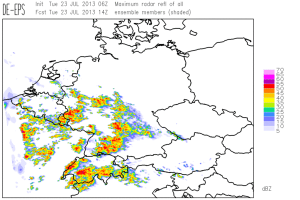
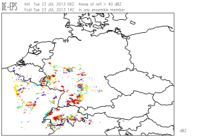
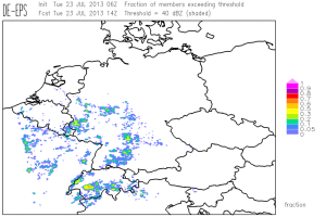
The following images illustrate the panel of 4 different visualizations of COSMO-DE EPS that we have made available for our Testbed, using the forecasts of radar reflectivity for 14 UTC yesterday (Tue 23 July 2013) as an example (base time: 06 UTC). Fig. 3 presents the envelope maximum simulated radar reflectivity of all model runs, which can be interpreted as a “worst case scenario”. In Fig. 4, areas with forecast radar reflectivity greater than 40 dbZ are highlighted with various colours, each of which belongs to one particular EPS run; this display is particularly neat because the user can track these colour-coded features from one forecast time step to the next. In Fig. 5, this information from Fig. 4 is condensed to the percentage of model runs which simulate a radar reflectivity greater than 40 dbZ; here, the “personal identity” of the individual EPS runs gets lost, but on the other hand you get an impression of how many EPS members exceed the threshold, which could not be seen from Fig. 4. All in all, Testbed participants can largely agree that this visualization is very useful and that the various displays ideally complement one another.

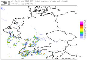
Fig. 6 shows the radar reflectivity forecast of the deterministic COSMO-DE run for the same time. Comparing it to the Figures 3 to 5, you can easily see that the ensemble runs add valuable information by forecasting a possibility of convection also further North over Western and Central Germany, where indeed lots of storms with severe wind and rain events occurred yesterday (see the verification in Fig. 1 again). They reduced the under-forecasting of thunderstorm activity, which was lately perceived by the Testbed participants, and are a helpful vehicle which shall prevent forecasters to become over-confident!

Fig. 3: COSMO-DE forecast for 14 UTC Tue 23 July 2013: maximum simulated radar reflectivity of all EPS runs.

Fig. 3: COSMO-DE forecast for 14 UTC Tue 23 July 2013: maximum simulated radar reflectivity of all EPS runs.

Fig. 4: COSMO-DE forecast for 14 UTC Tue 23 July 2013: areas of simulated radar reflectivity >40 dbZ in the individual EPS runs.

Fig. 4: COSMO-DE forecast for 14 UTC Tue 23 July 2013: areas of simulated radar reflectivity >40 dbZ in the individual EPS runs.

Fig. 5: COSMO-DE forecast for 14 UTC Tue 23 July 2013: percentage of EPS members with a simulated radar reflectivity >40 dbZ.

Fig. 5: COSMO-DE forecast for 14 UTC Tue 23 July 2013: percentage of EPS members with a simulated radar reflectivity >40 dbZ.

Fig. 6: COSMO-DE forecast for 14 UTC Tue 23 July 2013: simulated radat reflectivity according to the deterministic run.

Fig. 6: COSMO-DE forecast for 14 UTC Tue 23 July 2013: simulated radar reflectivity according to the deterministic run.

Since the precipitation signals were even stronger for today (Wed 24 July 2013) in the eastward shifting belt across Central Europe, today’s day 1 team even issued a level 2 area for the Southern half of Germany and a large surrounding level 1 for the rest of Germany, E France and the entire Alpine region. Despite the weak shear, the expected large number of storms was expected to result in rather many hail, wind and rain reports. This slightly controversial decision along with a hint of actionism by Christoph, wo actively involved the other group participants without prior announcement, resulted in a particularly lively online weather briefing today.

Since many of the storms across Germany formed quite early in the day and since Thilo was particularly quick with retrieving severe weather reports, a preliminary verification of today’s forecast can already be done: a few handfuls of heavy rain, severe wind and marginally large hail events occurred mainly over Germany, but probably not enough for a level 2. The forecast models have finally stopped their recent under-forecasting. Darned if you follow them, darned if you don’t!

Share

Tue 23 July 2013: une ouverture à la française

Yesterday’s pulse storms (see yesterday’s post) brought quite a lot of severe weather again. Excessive rain and localized severe wind gusts were scattered across France, Belgium, Southern Switzerland (Ticino) and Northern Italy (Lombardia and Alto Adige) in the afternoon and evening. The most stunning event was a fierce hailstorm between Bolzano and Trento in the Italian Alps: hailstones up to 4 cm and hurricane-force gusts managed to destroy 30.000 tons (!) of apples within minutes.

Turning to the second part of yesterday’s ouverture into a possibly memorable week, the hottest day since 2006 in England with temperatures up to 34°C was also followed by a night of widespread thunderstorms, as a short-wave trough provided some lift. These storms were accompanied by localized flooding and an amazing number of damaging lightning strokes, while hail and wind only played a minor role (non-severe hail in London and two cases of fallen trees near Stoke-on-Trent are known so far).

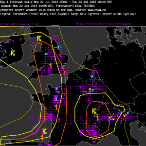
Fig. 1 presents the verification of yesterday’s day 1 forecast and the accompanying text. In general, the lightning areas were aligned pretty well with the detected lightning strokes (magenta dots), but the severe weather events occurred clearly more to the Northeast than expected (Belgium, N France, N Italy), which mainly resulted from an under-estimation of the severe weather potential associated with the pulse storms. The Western level 1, which was mainly issued due to the gradually increasing forcing and shear, verified better.

Fig. 1: Verification of the day 1 forecast valid for Mon 22 July 2013.

Fig. 1: Verification of the day 1 forecast valid for Mon 22 July 2013.

—–

Day 1 Forecast

Valid: Mon 22 Jul 2013 15:00 to Tue 23 Jul 2013 06:00 UTC

Issued: Mon 22 Jul 2013 14:55

Forecaster: ESSL TESTBED

A level 1 was issued for western France, northern Spain and southern England, Wales and surroundings for excessive rain, large hail and severe wind gusts.

Rich low-level moisture is overlapping with steep lapse rates from the east. CAPE will be around 1000 J/kg in the evening hours across northern France. A mid-level vort-max will move northward along the western French border spreading into the British Isles. Initiation of storm clusters is expected across France and England that move north/north-eastward. Main threat will be excessive precipitation due to rich moisture and due to storm movement parallel to the boundary.

Across France/Spain, larger CAPE enhances the potential of a few hail events. Additionally, vertical wind shear will be around 15 m/s, and a few organized storms are not ruled out. Bowing segments may than pose a threat of severe wind gusts.

Western Alps

Weak winds, high moisture and steep lapse rates are present, convergence in the complex terrain has lead to initiation. Pulse storm and stoirm cluster will be capable of producing isolated large hail or doenbursts. Main threat will be excessive rain due to the slow storm movement.

—–

Not so much change is expected for today (Tue 23 July 2013) yet, hence today’s day 1 forecast is looking pretty similar. The Western level 1 belt was shifted a bit to the East and the Alpine storms were left without a second level 1 area this time.

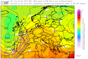
We are already having one eye at the development of the possible severe weather outbreak over Western Europe towards the end of the week, when GFS and ECMWF agree on an almost incredible weather pattern with a deep and strong SW flow that shall feature abundant CAPE and strong shear. We won’t see forecast maps like these too often in our lives. Fig. 2 shows a handful of them if you promise not to drool!

Fig. 2a: Today's ECMWF forecast of 500 hPa geopotential (black contours), temperature (clolor shades) and wind (barbs) for 18 UTC Sat 27 July 2013.

Fig. 2a: Today’s ECMWF forecast of 500 hPa geopotential (black contours), temperature (colour shades) and wind (barbs) for 18 UTC Sat 27 July 2013.

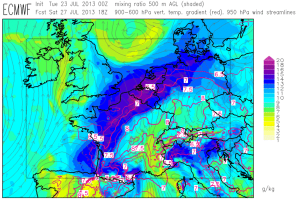
Fig. 2b: Today’s ECMWF forecast of mid-level lapse rates (red contour lines, plotted above 6.5 K/km) and low-level moisture (colour shades) for 18 UTC Sat 27 July 2013 (Paris domain).

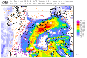
Fig. 2c: Today's ECMWF forecast for CAPE (color shades) and deep-layer shear (contour lines) for 18 UTC Sat 27 July 2013 (Paris domain).

Fig. 2c: Today’s ECMWF forecast of CAPE (colour shades) and deep-layer shear (contour lines) for 18 UTC Sat 27 July 2013 (Paris domain).

Today’s day 5 forecast is already covering Saturday, and it is not surprising that the team on duty used a strong wording – see Fig. 3 and text below.

Fig. 3: Day 5 forecast issued today, valid for Sat 27 July 2013.

Fig. 3: Day 5 forecast issued today, valid for Sat 27 July 2013.

—–

Day 5 Forecast

Valid: Sat 27 Jul 2013 06:00 to Sun 28 Jul 2013 06:00 UTC

Issued: Tue 23 Jul 2013 15:11

Forecaster: ESSL TESTBED

The severe weather situation of the previous day intensifies.

Severe weather is expected in France, the Benelux states and the northern part of Germany. With CAPE values up to 3500 J/kg and coincident 0-6 km wind shear of more than 20 m/s, well organized, persistent storm systems producing lightning, heavy rain, large hail, and strong windgusts can be expected.

In northern Italy and the south of Switzerland considerably high CAPE up to 3000 J/kg with weak wind and moderate 0-6 km wind shear less than 10 m/s can lead to slow moving convective cells with heavy rain, lightning, and possibly hail.

—–

Only fly in the ointment: it seems like the biggest storms day(s) will follow just after the end of the last Testbed week.

Share

Mon 22 July 2013: hot and hotter in the 4th Testbed week

The 4th and last Testbed week 2013 has begun, and 13 new participants from Poland, the Czech Republic, Germany, Austria, Portugal, Finland, the USA and Hongkong (!) have arrived. Furthermore, also the usual ESSL team is complemented by Kathrin (our Deputy Director) and by Thilo (our ESWD Quality Control Manager), which means that the activity in our building is more bustling than ever before.

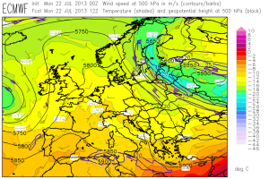
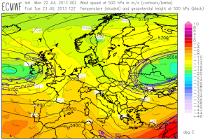
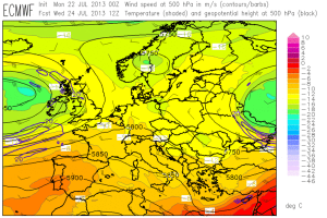
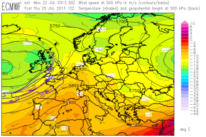
The weather seems to join in and there are convincing signs that it may approach top form by the end of the week. Fig. 1 presents the ECMWF 500 hPa forecasts in 24-hour time steps for today till Friday (26 July 2013) this week.

Fig. 1a: ECMWF forecast of 500 hPa geopotential (black contour lines), temperature (color shades) and wind (barbs) for 12 UTC Mon 22 July 2013.

Fig. 1b: As in Fig. 1a, but for 12 UTC Tue 23 July 2013.


Fig. 1c: As in Fig. 1a, but for 12 UTC Wed 24 July 2013.

Fig. 1c: As in Fig. 1a, but for 12 UTC Wed 24 July 2013.

Fig. 1d: As in Fig. 1a, but for 12 UTC Thu 25 July 2013.

Fig. 1d: As in Fig. 1a, but for 12 UTC Thu 25 July 2013.

Fig. 1e: As in Fig. 1a, but for 12 UTC Fri 26 July 2013.

Fig. 1e: As in Fig. 1a, but for 12 UTC Fri 26 July 2013.

The main feature this week is a broad upper-level ridge, which will very slowly move eastward and push an old cut-off low further into Russia. From the Atlantic, a new pronounced upper-level low will gradually come closer to Western Europe. Ahead of it, the Southwesterly flow is forecast to steadily increase during the week and advect hot air from Morocco and Iberia deeply into Central Europe, where temperatures within reach of record-breaking values can be expected by next weekend. Closer to the frontal zone, an extraordinary overlap of CAPE and shear may evolve from Spain via France to the BeNeLux countries and possibly into parts of Germany. This already smells like an outbreak of severe weather!

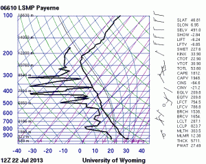
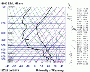
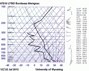
Until then we have to still lower our sights a little bit, but the week is already starting more exciting than the previous ones. Today’s thunderstorm activity was expected to be centered over two areas, the first one over the Western Alps and the second one in a belt from Western France into England. In the absence of synoptic-scale forcing (apart from the British Isles, which see some support from a first Atlantic trough overnight), the main trigger mechanism is provided on local scales by upvalley/upslope winds and by sea breeze fronts, respectively. The 12 UTC soundings from Payerne (CH), Milano (IT) and Bordeaux (FR) in Fig. 2 exemplarily outline today’s environment in the Western half of Europe: rich low-level moisture and fairly steep lapse rates create locally quite high CAPE with an conquerably small cap, but vertical wind shear is weak to non-existent.

Fig. 2a.

Fig. 2a.

Fig. 2b.

Fig. 2b.

Fig. 2c.

Fig. 2c.

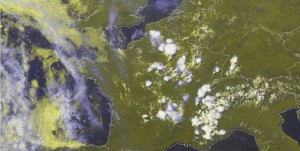
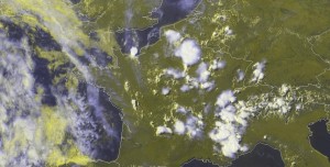
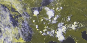
The afternoon turned quite interesting, when a lot of pulse storms formed across France, Belgium, Luxemburg and the Western Alps – in fact more than expected also over hilly or even flat terrain. The rapid scan satellite images revealed that some of the convection was obviously triggered secondarily by outflow boundaries or fast-moving gravity waves, which made it particularly difficult to predict the next instances of convective initiation.

Fig. 3a: E-View satellite image at 1330 UTC Mon 22 July 2013.

Fig. 3a: Meteosat E-View satellite image at 1330 UTC Mon 22 July 2013.

Fig. 3b: E-View satellite image at 1430 UTC Mon 22 July 2013.

Fig. 3b: Meteosat E-View satellite image at 1430 UTC Mon 22 July 2013.

Fig. 3c: E-View satellite image at 1530 UTC Mon 22 July 2013.

Fig. 3c: Meteosat E-View satellite image at 1530 UTC Mon 22 July 2013.

Fig. 3d: E-View satellite image at 1630 UTC Mon 22 July 2013.

Fig. 3d: Meteosat E-View satellite image at 1630 UTC Mon 22 July 2013.

Since we don’t have anything to verify yet on the first day of a new Testbed week, this posting finally has to turn into some more or less random “image-dropping” again. Fig. 3 shows an hourly sequence of satellite images of the French storms at 1330, 1430, 1530 and 1630 UTC. Enjoy the particularly beautiful initiation of still indecisive storms along the sea breeze front over Western France and an isolated, powerful storm over the French North coast. The latter dumped a cloudburst over Caen, which resulted in a severe flash flood and a few broken trees. This was today’s first severe weather event we learned about, but certainly not the last one. Stay tuned for tomorrow’s verification!

Share

Fri 19 July 2013: organized storms of opposite characters and in opposite areas

Today (Fri 19 July 2013) well-organized thunderstorms occurred on the one hand in the Baltic States, Belarus and the Ukraine, and on the other hand again over parts of Spain and France. Not only the geographic location of these two areas, but also the character of the storms was diametrically opposed to each other.

Fig. 1 briefly presents today’s large-scale weather pattern in form of the 500 hPa ECMWF forecast for 12 UTC.
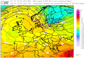
Fig. 1: ECMWF forecast for 12 UTC Fri 19 July 2013: 500 hPa geopotential (black contour lines), temperature (color shades) and wind (barbs).

Fig. 1: ECMWF forecast of 500 hPa geopotential (black contour lines), temperature (color shades) and wind (barbs) for 12 UTC Fri 19 July 2013.

The Spanish and French convection again formed in the vicinity of the shallow but everlasting upper-level low, which provided the familiar environment of moderate to high instability and rather weak (albeit locally enhanced by sea breezes) vertical wind shear. Fig. 2 shows another display of well-organized, powerful storms which have formed over Northern Spain the 11th day in a row.
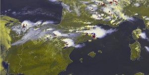
Fig. 2: Nowcast display at 1445 UTC Fri 22 July 2013: E-view satellite image and lightning detection within the last 15 minutes.

Fig. 2: Nowcast display at 1445 UTC Fri 22 July 2013: Meteosat E-view satellite image lightning detections within the last 15 minutes.

However, the arguably more interesting, because new, convection was the one over Northeastern Europe. As shall be shown below, this new environment of strong shear, strong forcing and limited CAPE provided bigger challenges for the Testbed participants than the x-th round of Spanish storms. Fig. 3 and 4 present the sequence of forecasts targeted on today.
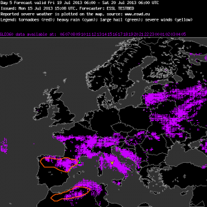
Fig. 3a: Verification of the day 5 forecast issued on Mon 15 July 2013, valid for Fri 19 July 2013.
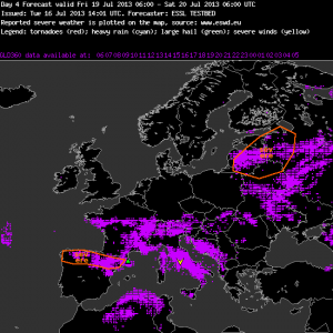
Fig. 3b: Verification of the day 4 forecast issued on Tue 16 July 2013, valid for Fri 19 July 2013.
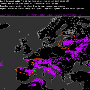
Fig. 3c: Verification of the day 3 forecast issued on Wed 17 July 2013, valid for Fri 19 July 2013.

On Mon 15 July 2013, no threat area was issued yet for today (Fig. 3a). The forecast uncertainty was still too big, as it was also noted in Monday’s blog entry here: “Towards the end of the week, it looks like the active frontal zone over the far North will run another attempt to erupt towards Eastern Europe, but by then discrepancies between GFS (not shown) and ECMWF become quite high and a concurrence with unstably stratified air is still doubtful.”

The first threat area for the Baltic States for today was issued on Tue 16 July 2013 (Fig. 3b), along with the comment: “(…) Low probablilty of severe weather (cold front) – forecasters should keep an eye at this region.”

On Wed 17 July 2013, the issued threat area was quite similar (Fig. 3c) but the accompanying text became more assuring: ” (…) A strong PV perturbation moving very quickly from North to South (ECMWF) and NW to SE (GFS) will reach that area around the middle of the day. Large values of 0=6 Km wind shear (up to 20 m/s) are expected over the same area. CAPE values aorund 800 J/Kg over Lithuania and Latvia (ECMWF) or 1200 J/Kg over Lithuania and Western Russia (GFS).”
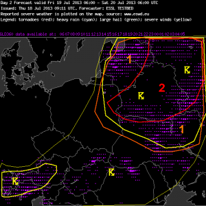
Fig. 4a: Verification of the day 2 forecast issued on Thu 18 July 2013, valid for Fri 19 July 2013.
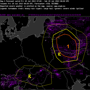
Fig. 4a: Verification of the day 2 forecast issued on Thu 18 July 2013, valid for Fri 19 July 2013.

Fig. 4b: Verification of the day 1 forecast issued on Fri 19 July 2013.

Fig. 4b: Verification of the day 1 forecast issued on Fri 19 July 2013.

For the day 2 and day 1 forecasts targeted on today (Fri 19 July 2013), respectively, the Warsaw subdomain was chosen. The day 2 team on Thursday was confident enough to issue a (low-end) level 2 area centered over Belarus (Fig. 4a) along with the following text:

“A strong through is approaching from Scandinavia. At the eastern side of the through warm and moist air with steepening laps rates will be advected. This will lead to some CAPE around 800 J/kg. During the day and in the night a well definded cold front will cross the northeastern parts of the forecast area at the left exit reagion of a strong upper level jet. With the approaching cold front DLS will increase to values around 15 – 20 m/s. At the coldfront modells predict wide spread convection which will likely developing into a line because of the good environmental shear. At the line widespread severe wind gust and isolated large hail are possible. At evening hours LLS will also increas to values around 10 m/s. The stronger LLS and low LCL will support the chance for tornadoes in some embedded supercells, mostly in the level 2 area. Therefore a low end level 2 was issued.

A head of the coldfront some well organized multicells and some supercells could develop in a weak convergent flow. The main threat would be large hail and isolated downbursts.”

While the confidence in severe thunderstorms had increased from day to day so far, today’s (Fri 19 July 2013) day 1 team performed a break and merely issued a level 1 for Belarus (Fig. 4b) and the following text:

“High probability of thunderstorms during the afternoon and early evening. Strong synoptic forcing is expected over the area with values of CAPE around 500 J/Kg but wind shear around 15-20 m/s in 0-6 Km, 10-15 in 0-3 Km and around 10 m/s in 0-1 Km. Toghether with the arrival of the cold front to the area a low level convergence line  will appear.”

Scanning the sequence of reasoning issued along with the forecasts gives the impression that little doubt was left about strong vertical wind shear and strong forcing, but that the amount of instability (expressed in terms of CAPE) became doubtful the closer the event came. In particular, low- to mid-level lapse rates did not seem to be too steep, which did not allow higher CAPE formation. The other “ingredient” for CAPE, enough low-level moisture, seemed to have been in place.

Another reason for the lower confidence in severe weather on day 1 was that the forecast models kept accelerating the cold front. Indeed, a convective line formed already early in the day across Latvia and Lithuania, which was accompanied by a pronounced wind shift (Fig. 5). This rapid development even made us issue an unscheduled nowcast with a wind watch valid from 09 till 11 UTC for areas ahead of the convective line (not shown).
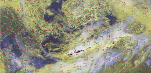
Fig. 5: Nowcast display at 0900 UTC Fri 19 July 2013: E-View satellite image, SYNOP reports and lightning detections within the last 15 minutes.

Fig. 5: Nowcast display at 0900 UTC Fri 19 July 2013: Meteosat E-View satellite image, SYNOP reports and lightning detections within the last 15 minutes.

As the line continued to move southeastward into Belarus in the afternoon, it kept its sharpness but the lightning activity got increasingly isolated. Indeed it seems like a lack of instability and the resulting too low cloud tops were the limiting factor here for a better shear consumption.

Till the time of writing, no severe weather reports arrived. The SYNOP gust reports were mostly in the 12 to 15 m/s range, hence an isolated severe gust (>25 m/s) could not be ruled out but should be considered quite unlikely.

While it was therefore a good choice for today’s day 1 team to only issue a level 1 instead of a level 2, the lightning verification showed that quite a lot of storms occurred outside the drawn areas (Fig. 4b). The team on duty seemed to focus too strongly on the main area of interest, something that even experienced forecasters are not immune against. Or was the approaching weekend already too close? 😉

We wish the participants of the third Testbed week a safe trip home and the participants of the fourth and last week a safe journey to Wiener Neustadt!
Share

Thu 18 July 2013: Action for Northeastern Europe around the corner

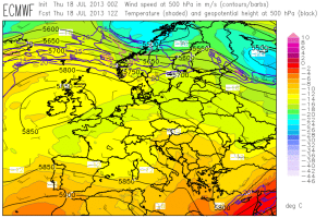
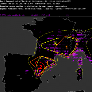
Today even two day 1 teams worked parallel on forecasts for the Toulouse domain, where another round of pulse storms over Southern France and the Western Alps and better organized storms over Northern Spain are expected, and for the Helsinki domain, where the beginning southward shift of the main frontal zone finally starts to create a more dynamic situation (Fig. 1). These two day 1 forecast are presented below. Enjoy!

Fig. 1: ECMWF forecast of 500 hPa geopotential (black contour lines), temperatur (color shading) and wind (barbs) for 12 UTC Thu 18 July 2013.

Fig. 1: ECMWF forecast of 500 hPa geopotential (black contour lines), temperature (color shading) and wind (barbs) for 12 UTC Thu 18 July 2013.

Fig. 2: Day 1 forecast valid for Thu 18 July 2013.

Fig. 2: Day 1 forecast valid for Thu 18 July 2013 for the Toulouse domain.

—–

Day 1 Forecast

Valid: Thu 18 Jul 2013 08:00 to Fri 19 Jul 2013 06:00 UTC

Issued: Thu 18 Jul 2013 09:31

Forecaster: ESSL TESTBED

A level 2 was issued for northeastern Spain mainly for large hail and severe wind gusts.

A level 1 was issued for southeastern France mainly for local excessive convective precipitation.

…other comments…

15 m/s 0-3 km shear is presented by most models over the northeastern edge of the Spanish Plateau. High dewpoints are returning into the Ebro Valley. Together with weak capping and deep convergence storms will be triggered and likely transform into supercell storms with a chance of large hail. High LCL heights > 1700m enhance both hail and severe wind gust threat. The coastal region will remain capped, tough.

France is under very weak shear conditions, limiting the organization and severe weather potential, but slow storm motion can lead to locally high precipitation accumulations.

Western France has high dewpoints and convergence and may trigger early storms.

The IPV feature moving into SW France at night seems not capable of triggering storms, no model produces precip there at night as CAPE has disappeared, possibly by advection of lower theta-e air from N Spain.

—–

Fig. 3: Day 1 forecast valid for Thu 18 July 2013 for the Helsinki domain.

Fig. 3: Day 1 forecast valid for Thu 18 July 2013 for the Helsinki domain.

—–

Day 1 Forecast

Valid: Thu 18 Jul 2013 08:00 to Fri 19 Jul 2013 06:00 UTC

Issued: Thu 18 Jul 2013 09:07

Forecaster: ESSL TESTBED

A level 1 was issued for NE Latvia, E Estonia and parts of NW Russia mainly for severe wind gusts, large hail, as well as a slight risk for tornados.

Embedded into a NW upper level flow is a short wave trough that is expected to lead to some severe weather in the regions indicated above.

Low level moisture is advected from the Baltic Sea leading to considerable CAPE levels around 1000J/kg. In the northern parts of the Level 1 area this overlaps with considerable low level shear and a low LCL which indicates a slight risk for tornados in this area. The strongest activity is expected already in the afternoon hours.

—–

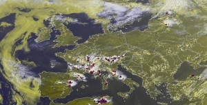
In due time for the afternoon nowcasting, plenty of storms formed up over the Toulouse domain. The “Team A” was excelling itself in issuing large watch areas mainly for hail and wind in Spain and mainly for heavy rain in France and the Western Alps. A parallel “Team B” covered the isolated convection over Latvia and Lithuania. As the last action of the day, even a tornado watch was issued for the Estonian storm visible in Fig. 4, as it moved into a region of Easterly surface wind and hence even stronger low-level shear than the models predicted.

Fig. 4: Nowcast display at 1545 UTC Thu 18 July 2013: E-View satellite channel product and lightning detections within the last 15 minutes.

Fig. 4: Nowcast display at 1545 UTC Thu 18 July 2013: Meteosat E-View satellite image and lightning detections within the last 15 minutes.

Tomorrow (Fri 19 July 2013) will be even more interesting for Northeastern Europe: an even stronger cold front and a pronounced short-wave trough will cross the Baltics, Poland and Belarus. The day 2 team issued the so far largest level 2 area centered over Belarus for tomorrow.

Share