Thu 18 July 2013: Action for Northeastern Europe around the corner

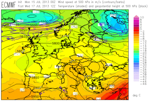
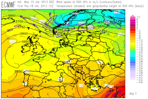
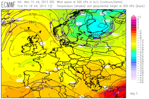
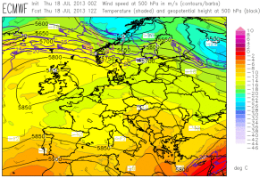
Today even two day 1 teams worked parallel on forecasts for the Toulouse domain, where another round of pulse storms over Southern France and the Western Alps and better organized storms over Northern Spain are expected, and for the Helsinki domain, where the beginning southward shift of the main frontal zone finally starts to create a more dynamic situation (Fig. 1). These two day 1 forecast are presented below. Enjoy!

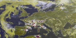
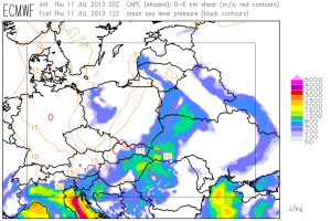
Fig. 1: ECMWF forecast of 500 hPa geopotential (black contour lines), temperatur (color shading) and wind (barbs) for 12 UTC Thu 18 July 2013.

Fig. 1: ECMWF forecast of 500 hPa geopotential (black contour lines), temperature (color shading) and wind (barbs) for 12 UTC Thu 18 July 2013.

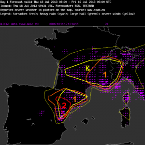
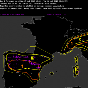
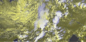
Fig. 2: Day 1 forecast valid for Thu 18 July 2013.

Fig. 2: Day 1 forecast valid for Thu 18 July 2013 for the Toulouse domain.

—–

Day 1 Forecast

Valid: Thu 18 Jul 2013 08:00 to Fri 19 Jul 2013 06:00 UTC

Issued: Thu 18 Jul 2013 09:31

Forecaster: ESSL TESTBED

A level 2 was issued for northeastern Spain mainly for large hail and severe wind gusts.

A level 1 was issued for southeastern France mainly for local excessive convective precipitation.

…other comments…

15 m/s 0-3 km shear is presented by most models over the northeastern edge of the Spanish Plateau. High dewpoints are returning into the Ebro Valley. Together with weak capping and deep convergence storms will be triggered and likely transform into supercell storms with a chance of large hail. High LCL heights > 1700m enhance both hail and severe wind gust threat. The coastal region will remain capped, tough.

France is under very weak shear conditions, limiting the organization and severe weather potential, but slow storm motion can lead to locally high precipitation accumulations.

Western France has high dewpoints and convergence and may trigger early storms.

The IPV feature moving into SW France at night seems not capable of triggering storms, no model produces precip there at night as CAPE has disappeared, possibly by advection of lower theta-e air from N Spain.

—–

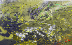
Fig. 3: Day 1 forecast valid for Thu 18 July 2013 for the Helsinki domain.

Fig. 3: Day 1 forecast valid for Thu 18 July 2013 for the Helsinki domain.

—–

Day 1 Forecast

Valid: Thu 18 Jul 2013 08:00 to Fri 19 Jul 2013 06:00 UTC

Issued: Thu 18 Jul 2013 09:07

Forecaster: ESSL TESTBED

A level 1 was issued for NE Latvia, E Estonia and parts of NW Russia mainly for severe wind gusts, large hail, as well as a slight risk for tornados.

Embedded into a NW upper level flow is a short wave trough that is expected to lead to some severe weather in the regions indicated above.

Low level moisture is advected from the Baltic Sea leading to considerable CAPE levels around 1000J/kg. In the northern parts of the Level 1 area this overlaps with considerable low level shear and a low LCL which indicates a slight risk for tornados in this area. The strongest activity is expected already in the afternoon hours.

—–

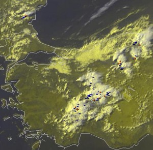
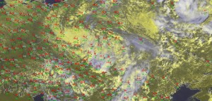
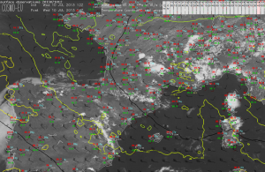
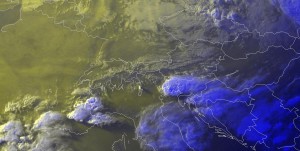
In due time for the afternoon nowcasting, plenty of storms formed up over the Toulouse domain. The “Team A” was excelling itself in issuing large watch areas mainly for hail and wind in Spain and mainly for heavy rain in France and the Western Alps. A parallel “Team B” covered the isolated convection over Latvia and Lithuania. As the last action of the day, even a tornado watch was issued for the Estonian storm visible in Fig. 4, as it moved into a region of Easterly surface wind and hence even stronger low-level shear than the models predicted.

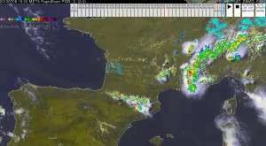
Fig. 4: Nowcast display at 1545 UTC Thu 18 July 2013: E-View satellite channel product and lightning detections within the last 15 minutes.

Fig. 4: Nowcast display at 1545 UTC Thu 18 July 2013: Meteosat E-View satellite image and lightning detections within the last 15 minutes.

Tomorrow (Fri 19 July 2013) will be even more interesting for Northeastern Europe: an even stronger cold front and a pronounced short-wave trough will cross the Baltics, Poland and Belarus. The day 2 team issued the so far largest level 2 area centered over Belarus for tomorrow.

Share

Wed 17 July 2013: the first tornado watch today and “nearcasting” of French storms yesterday

Today saw a premiere: the first tornado watch during the Testbed 2013 was issued! It is presented below in Fig. 1, along with the very comprehensible discussion that was added by the nowcasting team on duty.
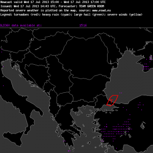
Fig. 1: Nowcast issued at 15 UTC Wed 17 July 2013, valid for the 15 to 17 UTC period.

—–

Nowcast

Valid: Wed 17 Jul 2013 15:00 to Wed 17 Jul 2013 17:00 UTC

Issued: Wed 17 Jul 2013 14:43

Forecaster: TEAM GREEN ROOM

Watches for imminent severe weather in the next 120 minutes are issued for these areas:

…extreme northwest Turkey and the adjacent Black Sea…

A persistent convective band over the southwest Black Sea has been sending convective elements southwestward torward the coast in Northwest Turkey just west of Istanbul. This convective line occasionally erupts cirrus plumes at times, which are carried back toward the northeast, as the winds alot above the EL are very strong and of the opposite direction from below. This line also intersects a sea-breeze convergence line which is evident from visible satellite imagery.

Although there is very little supporting evidence of a within in the sprase surface data, and the boundary layer air over the Black Sea does not appear to be appreciably colder than the sea-surface temperature, the visible and local radar trends suggest that this persistent convective line is associated with a local convergence zone. The numerical models support CAPE values anywhere from 500-1000 J/kg, suggesting there may be adequate instability to stretch any possible vertical vorticity along the convergence zone into a brief non-mesocyclone tornado over the water (a waterspout). Any waterspouts that form close to the coast have the possibility to move onshore and cause weak tornadic damage.

—–

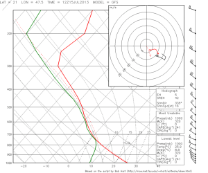
Fig. 2 shows the cumulus band over the Black Sea which prompted the team to issue this tornado watch, and Fig. 3 presents the 12 UTC Istanbul sounding. The rather cool upper levels in the vicinity of the weak cut-off low over the Balkans resulted in at least a little bit of uncapped CAPE over the Black Sea. The pronounced low-level Northeasterly winds and the upper-level Southwesterly winds can clearly be seen in the sounding. This bizarre wind profile resulted in well-organized showers with weak electrification, which very slowly moved to the Southwest while their anvils were carried away in the opposite direction. The intersection of this supposed convergence line with the usual “frictional” convergence along the coast (visible by small cumulus clouds in Fig. 2) was a suspicious setup for a concentration of low-level vorticity into a waterspout spin-up. We were particularly aware of this scenario, because yesterday two spouts were observed at the Romanian coast in a very similar setup of two intersecting convergence lines. Till the time of writing, no spout reports from the Istanbul area have arrived yet, though.
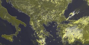
Fig. 2: Nowcast display at 1430 UTC Wed 17 July 2013: E-View satellite channel and lightning detections within the last 5 minutes.

Fig. 2: Nowcast display at 1430 UTC Wed 17 July 2013: Meteosat E-View satellite image and lightning detections within the last 5 minutes.
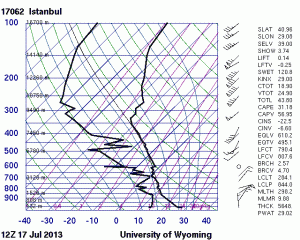
Fig. 3: 12 UTC Wed 17July 2013 at Istanbul (Turkey).

Fig. 3: 12 UTC Wed 17 July 2013 sounding from Istanbul (Turkey).

Apart from that, it seems like the participants get a bit fed up with forecasting the almost same Spanish storms from day to day. The day 1 team this morning chose the Sofia domain (independent from the surprising Istanbul scene, but for a chance of organized storms under strong Southwesterly upper-level flow over the Turkish mainland, which did not really materialize), and the day 2 team even switched to the Helsinki domain. More on this foreseeable change over Northeastern Europe will be written tomorrow.

Before that, however, still the nowcasting was arguably today’s most interesting part: Yesterday’s storms over Northern Spain and Southern France did not only bring another regional outbreak of severe weather, but also provided a good opportunity to test the “NearCast” product developed by Ralph Peterson from the University of Wisconsin, who is also on site in Wiener Neustadt this week.

This product displays fields of the equivalent-potential temperature at 778 and 497 hPa derived from satellite retrievals. These fields are computed hourly (at least in areas where no obstructive cloudiness is present), and a Lagrangian advection with GFS forecast winds is computed for up to 9 hours into the future. Users can switch between a separate view of either of these fields, or of the resulting difference, which shows potentially stable or unstable areas. The NearCast product has been a matter of active discussions for the whole Testbed period, as not everybody agrees on the concept of potential instability: critics claim that it is rather a “proxy” for good or not good conditions for convection than it actually reflects the physics of (surface-based) convection. Though not everybody acknowledged the product’s added value in comparison to conventional satellite products, it was generally agreed that it performed well.

During yesterday’s treatment of the French storms, Ralph pointed out another, less obvious possibility to use the 778 hPa theta_e field alone. In a quiescent situation like the present one with an absence of pronounced horizontal temperature variations, its maxima and minima can chiefly be interpreted as local maxima or minima of moisture on top of the growing convective boundary layer. A moisture minimum at ~800 hPa means that vertical mixing will effectively reduce the near-surface moisture by means of strong upward mixing as soon as the convective boundary layer grows deep enough. Conversely, near-surface moisture is largely preserved if the layers around 800 hPa also show a high moisture content.

This interpretation was put to the acid test yesterday (Tue 16 July 2013) for the situation prior to the storms over Southern France. The surface map at 08 UTC showed a limited moisture gradient in this area with dew points around 19°C in the foreland of the Pyrenees and around 15°C further North (Fig. 4). The 08 UTC NearCast theta_e field confirmed this moisture gradient also at 778 hPa (Fig. 5). Would daytime mixing indeed act to further decrease the surface dew points to the North, or, conversely, would the reduced daytime mixing (along with further evaporation) manage to maintain the very moist boundary layer over Southermost France?
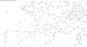
Fig. 4: 08 UTC Tue 16 July 2013 surface map.

Fig. 4: NearCast equivalent-potential temperature at 778 hPa at 08 UTC Tue 16 July 2013.

Fig. 5: NearCast equivalent-potential temperature at 778 hPa at 08 UTC Tue 16 July 2013.

Et voilà, Fig. 6 shows a satellite display and the surface observations four hours later, at 12 UTC. Dew points have indeed lingered around 20°C close to the Pyrenees, where numerous storms were now firing up. On the other hand, they have dropped as low as 11 to 12°C on the other side of this “dryline” from Bordeaux to the Northeast. The 12 UTC Bordeaux sounding confirmed a deep and well-mixed boundary layer, in which the lack of moisture precluded any storm development (Fig. 7).
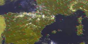
Fig. 6: Nowcast display at 12 UTC Tue 16 July 2013: E-view satellite channel and SYNOP observations.

Fig. 6: Nowcast display at 1200 UTC Tue 16 July 2013: Meteosat E-view satellite image and SYNOP observations.
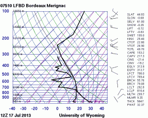
Fig. 7: 12 UTC Tue 16 July 2013 sounding from Bordeaux (France).

Fig. 7: 12 UTC Tue 16 July 2013 sounding from Bordeaux (France).

In the following hours, numerous pulse storms formed over Southern France with large hail, severe wind gusts and excessive rain in many places. Over Northern Spain, deep-layer shear was slightly enhanced to 15 m/s, which was sufficient for a better storm organization. The most significant storm was a bow echo which brought a 34 m/s wind gust in Miranda de Ebro and extensive hail and wind damage in the La Rioja region nearby.

While the forecast models had agreed on convective initiation over Northern Spain, they had been much more reluctant with precipitation signals over Southern France. However, in yesterday’s day 1 forecast we had extended the 50% thunder line and the level 1 well into Southern France, since the observed high dew points and the probably reduced vertical mixing (see above) convinced us of a high CAPE buildup and an explosive release as soon as the outflow boundaries from the Pyrenees would move into the foreland. The other level 1 area in the Western Alps for a chance of excessive rain worked out as well. All in all, we could agree that this was the so far best forecast of the entire Testbed period, which is why it is presented in full detail in Fig. 8. The afternoon nowcasts were equally successful (not shown). And now some champagne, please!
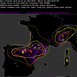
Fig. 8: Verification of the day 1 forecast valid for Tue 16 July 2013.

Fig. 8: Verification of the day 1 forecast valid for Tue 16 July 2013.

—–

Day 1 Forecast

Valid: Tue 16 Jul 2013 08:00 to Wed 17 Jul 2013 06:00 UTC

Issued: Tue 16 Jul 2013 08:55

Forecaster: ESSL TESTBED

A level 1 was issued for N and E Spain and s France mainly for large hail and severe wind gusts.

A level 1 was issued for NW Italy mainly for heavy rainfall.

…other comments…

N Spain, S France:

Moderate CAPE (~1000 J/kg) can build where coastal moisture gets advected inland. 0-6 km shear wind shear is below 15 m/s. We expect some pulse storms. The strongest ones may bring localized hail and downbursts.

E Spain:

0-6 km wind shear increases up to 20 m/s further South and a travelling short-wave trough provides some lift, but it is still doubtful if the strong cap can be broken. If storms form, they can organize into strong multicells or isolated supercells with large hail and severe wind gusts.

Western Alps:

We expect afternoon and evening storms in an environment of weak vertical wind shear. CAPE is rather low on the French and Swiss side, but increases to ~1000 J/kg over the Po valley, where surface observations show more low-level moisture (dew points around 19C). With the arrival of a weak short-wave trough, convection can continue into the night hours and may grow into a larger cluster. Heavy precipitation is possible.

—–
Share

Tue 16 July 2013: unexpected supercells yesterday – mesoscale accidents call for forensic meteorology!

Today’s verification session turned into an instance of “forensic meteorology”, as supercell storms occurred yesterday afternoon in two areas that we were not fully aware of.

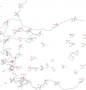
The first area was Turkey, were the satellite loops indicated several suspicious storms with either strongly left- or right-moving tracks with respect to the Southwesterly upper-level flow. Fig. 1 shows the situation at 1450 UTC. from satellite view.

Fig. 1: Nowcast display at 1450 UTC Mon 15 July 2013 (zoom on Turkey): E-View satellite channel and detected lightning within the last 5 minutes.

Fig. 1: Nowcast display at 1450 UTC Mon 15 July 2013 (zoom on Turkey): Meteosat E-View satellite image and detected lightning within the last 5 minutes.

Out of the scattered afternoon storms over Turkey, the two Northwesternmost ones in Fig. 1 were most interesting. They were tiny and did not even produce any lightning at that time. However, their V-shaped appearance already marked them as possible supercells. The different orientation of their anvils further indicated their strongly deviant motion, which was confirmed by the satellite loops: the Western supercell moved almost due North, and the Eastern one almost due East.

Fig. 2: 12 UTC Mon 15 July 2013 sounding from Ankara (Turkey).

Fig. 2: 12 UTC Mon 15 July 2013 sounding from Ankara (Turkey).

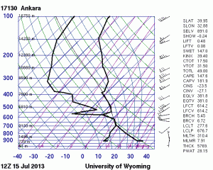
The next step of the “forensic meteorology task force” was to find a proximity sounding. Indeed the 12 UTC Ankara sounding was launched close to the areas of convection (Fig. 2). It showed a typical situation for summertime Turkey with a very deep and dry boundary layer and neutral (i.e., moist-isentropic) lapse rates aloft (disregarding the obviously erroneous measurement at 570 hPa). This is typical for arid regions and strong summertime insolation, when the sensible heat flux is immediately converted into convective mixing. The more eye-catching feature was the rather strong Southwesterly upper-level flow with 20 m/s at 500 hPa. Even though the cloud-bearing layer was remarkably shallow with cloud bases near 3 km and cloud tops near 7 km, the effective vertical wind was indeed considered supportive of “high-based and low-topped supercells” (copyright Pieter).

Fig. 3a: 14 UTC Mon 15 July 2013 surface map (zoom onto Turkey).

Fig. 3a: 14 UTC Mon 15 July 2013 surface map (zoom onto Turkey).

Fig. 3b: 15 UTC Mon 15 July 2013 surface map (zoom onto Turkey).

Fig. 3b: 15 UTC Mon 15 July 2013 surface map (zoom onto Turkey).

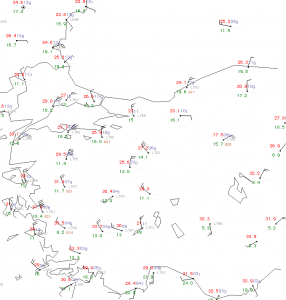
The 14 and 15 UTC surface maps (Fig. 3a and 3b) also revealed the development of a very strong circulation around the daily thermal low over South-Central Turkey. Eskisehir station (LTBI), situated immediately downstream of the conspicuous left-moving storm in Fig. 1, reported NW wind with 15 m/s at 15 UTC. Further East, Ankara station (LTAC) was not far from the right-moving storm and showed E wind with 5 m/s at 14 UTC. Modifying the sounding in Fig. 2 with these low-level winds would indeed create plenty of negative storm-relative helicity and an enhanced chance for anticyclonic, left-moving supercells around Eskisehir, and vice versa around Ankara, the way it was indeed observed. Ankara also got a direct hit by one of the other storms between 14 and 15 UTC: the temperature dropped from 30 to 18°C, the dew point rose from 10 to 16°C and a maximum gust of 28 m/s was recorded. This confirmed the potential for severe downbursts in such an environment of considerable wind shear and at the same time very dry subcloud layers. [Side note: The allegedly even higher mean wind and wind gusts during fair weather conditions at 15 UTC in Izmir (LTBJ) at the West coast are a coding error – knots were accidentally coded as m/s.]

Fig. 1: Nowcast display at 1450 UTC Mon 15 July 2013 (zoom on Turkey): E-View satellite channel and detected lightning within the last 5 minutes.

Fig. 4: Nowcast display at 1300 UTC Mon 15 July 2013: Meteosat E-View satellite image, SYNOP observations and lightning detections within the last 5 minutes.

The second area which saw a supercell yesterday (Mon 15 July 2013) was Eastern Hungary, which was crossed by a cold front from the Northwest. A prefrontal environment of a few hundred J/kg of CAPE and deep-layer shear between 10 and 15 m/s in the Northwesterly flow did not look all too conducive for organized storms. However, around noon surface observations indicated that a shallow low formation in the wake of the Slovakian High Tatra mountains made the wind turn back to Southerly directions over a confined region of Eastern Hungary which also still saw enough sunshine. The nowcast display at 1300 UTC (Fig. 4) shows an arc of small cumulus clouds along the cold front from Hungary across Western Slovakia into the Eastern Czech Republic. Ahead of it, the station of Debrecen (LHDC) reported weak Southerly wind. The supercell formed right at that moment in close vicinity and tracked Southeastward. Its long-lived rotation was confirmed by a doppler radar analyses of the Hungarian Meteorological Service (OMSZ) and by pictures taken by spotters. Small hail, strong wind gusts (the highest measurement was 20 m/s) and maybe marginally flooding occurred with this storm.

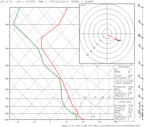
Fig. 4a: GFS forecast sounding for 12 UTC Mon 15 July 2013 for Debrecen (Hungary).

Fig. 4a: GFS forecast sounding for 12 UTC Mon 15 July 2013 for Debrecen (Hungary).

Fig. 4b: A in Fig. 4a, but for ECMWF.

Fig. 4b: As in Fig. 4a, but for ECMWF.

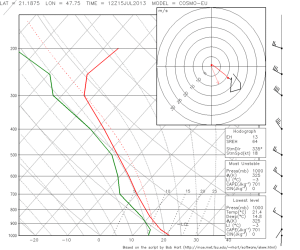
Fig. 4c: As in Fig. 4a, but for COSMO-EU.

Fig. 4c: As in Fig. 4a, but for COSMO-EU.

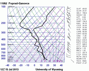
It is worth to examine the 12 UTC forecast soundings for Debrecen from GFS, ECMWF and COSMO-EU models (Fig. 5). While the models agreed on a few hundred J/kg of CAPE, the near-surface wind field was forecast in a different way: GFS showed a smooth Northwesterly flow (and consequently a drier boundary layer), ECMWF already weakened the surface winds and COSMO-EU even had signs of a temporary Southerly surface wind, the way it actually occurred. It seems like the finer model resolution helped significantly in capturing this mesoscale low development. Inserting the 13 UTC Debrecen measurements (temperature of 24°C, dew point of 14°C and weak Southerly wind) in the 12 UTC Poprad sounding (Fig. 5), which was already behind the cold front but otherwise in vicinity, indeed yields substantial CAPE and deep layer shear of more than 20 m/s, even more than the most “optimistic” forecast by COSMO-EU had shown.

Fig. 5: 12 UTC Mon 15 July 2013 sounding from Poprad (Slovakia).

Fig. 5: 12 UTC Mon 15 July 2013 sounding from Poprad (Slovakia).

Both the Turkish and the Hungarian case show situations when mesoscale processes favourably modified the conditions for organized convection despite a rather inconspicuous large-scale setup. Greg mentioned the nice term “mesoscale accidents”, which is colloquially used in the United States for such happenings. The structured land/sea distribution and orography of Europe makes such “mesoscale accidents” in Europe much more common than in the United States.

Today, as many maps as never before were manually drawn at the ESSL testbed: Yesterday’s Hungarian case was so alluring that it was re-analyzed by hand. Further hand analysis were drawn today for the 06 UTC, 07 UTC and 12 UTC maps of the Toulouse domain, which was – despite yesterday’s surprises – again chosen for today’s day 1 forecast. Yesterday a lot of storms occurred there and positively verified our lightning forecast, but severe weather was neither reported from within our level 1 area (see yesterday’s post) nor from anywhere else.

Share

Mon 15 July 2013: new participants but no new weather

Hooray for the third Testbed week! 10 new participants from Poland, Hungary, Austria, Germany, Spain and the United States arrived, but did not bring any new weather yet.

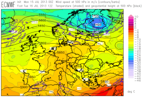
Fig 1: ECMWF forecasts of 500 hPa geopotential (black contours), temperature (color shades) and wind (barbs) for the week from Mon 15 July 2013 to Fri 19 July 2013 (12 UTC each day).

Fig 1: ECMWF forecasts of 500 hPa geopotential (black contours), temperature (colour shades) and wind (barbs) for the week from Mon 15 July 2013 to Fri 19 July 2013 (12 UTC each day).

Fig. 1 presents the daily sequence of the 500 hPa ECMWF forecasts. The primary interest of this week will still be on Spain and (hold on tight!) even Northern Algeria, where the subtropical branch of the jet stream along with opposed Easterly low-level flow will boost vertical wind shear to values in excess of 20 m/s. Up to moderate CAPE may form where rich low-level moisture gets advected inland. It is anticipated that a series of short-wave troughs will discriminate between days with only isolated storms that struggle against the strong cap, and other days with rather widespread activity over Spain.

Otherwise, weakly organized thunderstorms are expected in the range of slowly decaying upper-level lows over Eastern Europe and the Balkans, and – especially after midweek – over the orography of Southern France and the Western Alps despite weak upper-level ridging. Towards the end of the week, it looks like the active frontal zone over the far North will run another attempt to erupt towards Eastern Europe, but by then discrepancies between GFS (not shown) and ECMWF become quite high and a concurrence with unstably stratified air is still doubtful.

The day 1 forecast for the Toulouse domain which opened this week is inserted below in Fig.2.

Fig. 2: Day 1 forecast issued on Mon 15 July 2013.

—–
Day 1 Forecast

Valid: Mon 15 Jul 2013 15:00 to Tue 16 Jul 2013 06:00 UTC

Issued: Mon 15 Jul 2013 14:51

Forecaster: ESSL TESTBED

A level 1 was issued for central Iberian Peninsula mainly for large hail.

A level 1 was issued for northern Italy mainly for large hail.

There is a high chance of storms over parts of Spain and northern Italy as result of weakly capped CAPE and convergence resulting from orography. In combination with around 10 m/s deep layer shear multicell storms should be the mode. Over northeastern Italy and eastern Spain the 0-6 km shear reaches over 15 m/s which supports weak supercells with large hail as primary threat.

Isolated severe wind gusts are not as likely due to weak flow and rather moist mid levels with mediocre lapse rates over most of Spain and northern Italy with the exception of northwestern Italy where Milan 12Z sounding shows a very dry layer at 600 hPa.

The probability of supercellular tornadoes is very low because of absence of significant low level shear (0-1 km shear less than 7 m/s in most of the area)

Storms may remain active overnight over Spain and northern Italy.

—–
While we were still working on our day 1 and day 2 forecast, respectively, the sky darkened outside our windows and some passing thundery showers reminded us that we should not completely omit today’s weak cold front, which was leisurely moving Southeastward into Eastern Europe and across the Alps. In the Southern Alpine region deep-layer shear up to 20 m/s overlapped with non-zero CAPE in the forecast maps, the low-level flow was still Southerly, and last week’s experiences had taught us utmost care in such situations.The situation had a striking similarity with last Thursday (extensively covered in the last two blog entries), despite a lower degree of moisture, lapse rates, wind shear and everything else you can imagine or not. We awaited some better organized storms to form over the Southern Alpine region again.

However, due to active discussions and the far from trivial situation, the day 1 to 5 forecasts took longer than expected and no time was left for nowcasting any more. This was no serious matter, because not too many interesting storms had formed yet. The Spanish storms were only slowly gearing up, and in the Southern Alpine region a little bit happened over Slovenia and Croatia but Northern Italy was left out this time (at least till the time of writing). Midnight isn’t exactly the right time to find out why.

Share

Fri 12 July 2013: take home messages and how details can spoil a forecast

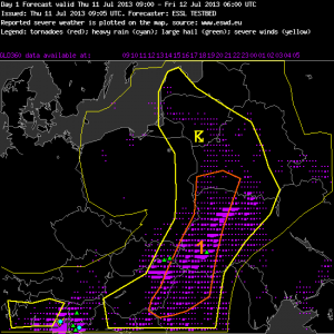
Yesterday (Thu 11 July 2013) some severe weather occurred with the thunderstorm activity along and ahead of the cold front of the low pressure system centred over Poland, which was already featured in yesterday’s post. First large hail reports arrived from E Slovakia and the W Ukraine in the early afternoon. Additional hailstorms formed a little later over Western portions of Slovenia and Croatia, where the city of Rijeka also suffered some flooding. In Italy, hail, flooding and severe wind gusts were reported from Florence (2 people injured by falling trees) and Perugia with pulse storms in the afternoon, and especially along the Northern Adriatic coast with a giant evening supercell that formed the climax of yesterday’s activities. All in all, this was quite a lot of severe weather for a rather moderate-looking day, and all but the Florence and Perugia events occurred within the domain of yesterday’s day 1 forecast (Fig. 1).

Fig. 1: Verification of the day 1 forecast issued on Thu 11 July 2013.

Fig. 1: Verification of the day 1 forecast issued on Thu 11 July 2013.

—–
Day 1 Forecast

Valid: Thu 11 Jul 2013 09:00 to Fri 12 Jul 2013 06:00 UTC

Issued: Thu 11 Jul 2013 09:05

Forecaster: ESSL TESTBED

A level 1 was issued for south of Belarus, west of Ukraine and northwest of Romania for heavy rain, hail and strong winds.

Most severe thunderstorms is expected to form along or ahead of a cold front moving eastwards. Moderate CAPE (up to 2000-2500 J/kg) is predicted ahead of the cold front, and the rear edge of this area overlaps with increasing 0-6km wind shear (~15m/s). We expect some multicells or even a few supercells, and later the formation of a convective line is possible as well. There is a chance of large hail and severe wind gusts.

Further South (NW Romania), vertical wind shear is weaker, but instability is equally high. Strong pulse storms can form especially over the mountains with a risk of localized heavy rain and marginally large hail.

—–
Today’s verification of this forecast showed a partial success with the big Eastern 50% lightning area and the Ukrainian hail report, two closely missed Slovakian hail reports and unfortunately a complete miss of the Slovenian, Croatian and Italian events. It turned out that three small misinterpreted details had a big effect and led to this forecast errors, as it is tried to reproduce below. Fig. 2 shows the situation at 08 UTC, approximately the time when the day 1 group was ready to issue their forecast.

Fig. 2: Nowcast display at 0800 UTC Thu 11 July 2013: E-View satellite channel, SYNOP reports and lightning detections within the last 15 minutes.

Fig. 2: Nowcast display at 0800 UTC Thu 11 July 2013: Meteosat E-View satellite image, SYNOP reports and lightning detections within the last 15 minutes.

Bust #1: Over E Hungary and the W Ukraine, a band of cumulus clouds with limited lightning activity was visible. The station measurements as well as our commonsense suggested that this band would already indicate a wind shift line that outran the following cold front. Since there was still a window with clear skies visible behind this line, we also expected storms further West over Hungary, but the then Westerly low-level wind and a beginning decrease of low-level moisture should reduce both vertical wind shear and CAPE. Hence we expected significantly enhanced chances of severe weather only in the moist Southerly flow further ahead, and the Western border of the level 1 area was aligned with the present position of this cumulus band. However, later observations soon revealed that this first outflow boundary decayed and most of the low-level convergence returned to the front line further West, where strong and well-organized storms formed around noon and the Slovakian hail reports were placed just outside our level 1 area.

Bust #2: Slovenia was excluded from the 50% thunder area. The latest satellite data (see Fig. 2 again) already showed plenty of cloudiness and rather cooler and drier Northeasterly winds, as the tail of the “backdoor” cold front moved around the Alps. In fact, however, some hours of insolation followed again and the nose of this wind regime became stationary over the Western parts of the country, where the strong convergence triggered the first hailstorms. Remnants of these storms also brought fairly much lightning over the rest of Slovenia.

Bust #3: Northern Italy was included into the 50% thunder area, but no second level 1 area was issued. We expected some thunderstorm activity overnight with the arrival of this “backdoor” cold front, but were not confident about still a presence of surface-based instability then. Hence the storms’ severity should be suppressed despite 15 m/s deep-layer shear. However, all the calamities came together in this area: Steady Southerly wind raised the dew points and enhanced vertical wind shear, and the thunderstorm activity already exploded in the evening instead of slowly gearing up during the night.

Even though we had good reasoning for our forecast (or at least thought so), things turned out different. The saying that you can learn more from one poor forecast than from a hundred successful ones was proven right again. Cases like this one only emphasize the importance of a continuous monitoring of the situation, in order to quickly react to any unexpected developments.

Looking back, the first misinterpretation could already have been corrected one hour later with the newly arrived 09 UTC observations. The second and third misinterpretation were recognizable shortly after noon, when the clearing skies and the strength and persistence of the convergence zone over Western Slovenia became visible, as well as the moist Southerly inflow over Northeastern Italy with a rise of the dew points up to 22°C.

These events only added to a longer list of days with an underforecasting of severe weather in this second Testbed week. In many cases, these severe storms formed downwind of mountain barriers (Spanish plateau, Appennin, Alps), where low-level sea breezes and upvalley winds in their wake were opposed to the mid-level flow. This favourably influences all the ingredients for severe storms: low-level moisture (originating from the sea surface or moist lowlands) gets advected under steep lapse rates (originating from the mountains), the nose of this onshore/upvaelly winds provides a triggering convergence zone, and the vertical wind shear gets enhanced by roughly 5 m/s.

Fig. 3: 12 UTC Thu 11 July 2013 sounding from Udine (IT).

Fig. 3: 12 UTC Thu 11 July 2013 sounding from Udine (IT).

The first and foremost take home message from this second Testbed week is that these mesoscale modifications can frequently turn a “marginally non-severe” setup (e.g. shown by yesterday’s 12 UTC Udine sounding in Fig. 3) into a “marginally severe” setup and can account for a number of severe weather events in an otherwise inconspicuous situation.

Turning less serious (which is hopefully allowed by the end of the week), the second take home message is that Northern Italy is always moister than expected. The third take home message is that the atmosphere has a great sensitivity towards what we do, say and feel at the Testbed – in the first two weeks the weather always turned interesting as soon as people started to complain how boring it is. So, dear participants of the third Testbed week, please start to complain as soon and as often as possible if you want to do us (and yourself) any good! Other than that: feel very welcome in Wiener Neustadt!

Share

Thu 11 July 2013: a change over Eastern Europe and the beauty of storms from satellite perspective

Our joint Thursday dinner and the subsequent whiskey tasting in a Scottish pub prevent a longer post today, but at least an outline of an eagerly awaited change and some satellite snapshot of particularly beautiful storms should be presented.

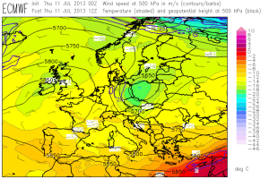
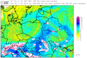
An upper-level low was moving southeastward today over Poland and provided pronounced large-scale lift for the downstream areas of E Slovakia, E Hungary, the W Ukraine and NW Romania (Fig. 1). Near the surface, it was accompanied by a cold front which took over the role of the main trigger for thunderstorm development. Along the front, converging winds resulted in a belt of enhanced low-level moisture, which at least partly overlapped with moderately steep lapse rates aloft (Fig. 2). The rear area of the resulting belt of 500 to 1200 J/kg CAPE was overspread by increasing deep-layer shear between 15 and 20 m/s (Fig. 3). Finally!

Fig. 1: ECMWF forecast of 500 hPa geopotential (black contour lines), temperature (colour shading) and wind (barbs) at 12 UTC Thu 11 July 2013.

Fig. 2: ECMWF forecast of low-level moisture (colour shading) and mid-level lapse rates (red contour lines, plotted above 6.5 K/km) at 12 UTC Thu 11 July 2013.

Fig. 3: ECMWF forecast for CAPE (color shading) and 0-6 km vertical wind shear (contour lines) at 12 UTC Thu 11 July 2013.

Fig. 3: ECMWF forecast of CAPE (colour shading) and 0-6 km vertical wind shear (contour lines) at 12 UTC Thu 11 July 2013.

A verification of today’s forecasts and nowcasts will be left for tomorrow, but for starters it can already be mentioned that the expected well-organized storms formed over the area of interest. In other parts of Europe, conditions still remained the same: A stationary high pressure area over the British Isles and weak geopotential gradient with daytime thunderstorms over the mountains of Spain, S France and Italy.

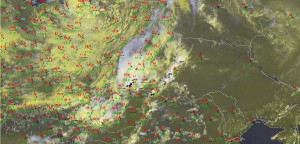
A few satellite images of particularly beautiful thunderstorms are presented below. Fig. 4 shows the well-organized thunderstorms over Eastern Europe at 1315 UTC. Of particular interest is the big storm over the Slovak/Hungarian border which dropped 3 cm sized hail in Trebišov (Slovakia) at that time; its flanking line extends well into the Hungarian plain.

Fig. 4: E-View satellite channel at 1315 UTC Thu 11 July 2013.

Fig. 4: Meteosat E-View satellite image at 1315 UTC Thu 11 July 2013.

As the tail of the cold front crossed the Alpine chain in the afternoon and evening, severe thunderstorms were also triggered over Slovenia, Croatia and N Italy. Fig. 5 shows a particularly strong and right-moving sunset storm, possibly a supercell, over Friuli (Italy) as it headed towards the Adriatic coast. About 20 minutes later, it dropped a hail layer onto Caorle, where holiday makers could mix their evening cocktails with natural ice.

Fig. 5: E-View satellite channel at 1825 UTC Thu 11 July 2013.

Fig. 5: Meteosat E-View satellite image at 1825 UTC Thu 11 July 2013.

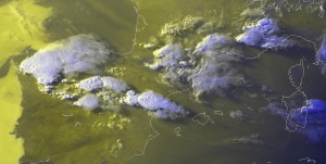
Last but not least, Fig. 6 shows some of the healthy looking storms which are forming over Spain each day in an environment of locally very high CAPE and 10 to 15 m/s deep-layer shear. Today they backbuilded so strongly towards the West that they almost encountered the sea fog over the adjacent Atlantic Ocean.

Fig. 6: E-View satellite channel at 1835 UTC Thu 11 July 2013.

Fig. 6: Meteosat E-View satellite image at 1835 UTC Thu 11 July 2013.

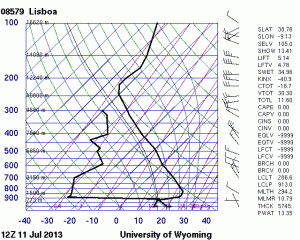
The 12 UTC Lissabon sounding in Fig. 7 illustrates the special stratification along the coastal areas of the Iberian Peninsula. A thin cool and moist layer is in place over the sea surfaces, capped by the hot and dry inland air as it gets advected over the open sea. Of course these low levels are way too cool to allow any deep convection, but once they get picked up by upslope flow and get exposed to some hours (or days) of strong insolation, “loaded gun” type situations are created with explosive thunderstorm formation once the cap is broken.

Fig. 7: 12 UTC Thu 11 July 2013 Lissabon sounding.

Fig. 7: 12 UTC Thu 11 July 2013 sounding from Lissabon (PT).

And what’s the weather doing on site? Last night, the Eastern European cold front also passed Wiener Neustadt and brought some non-organized thunderstorms in the vicinity. Those who stayed up long enough reported a very nice lightning show. Today it cleared up again with a few degrees lower temperatures. In the medium range, it seems like the quiet summer weather will still continue in the Alpine region.

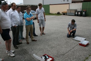
Today after lunch we got visited by Christian Vergeiner, who is doing electrical field measurements of lightning for the Austrian Lightning Detection and Indicating System (ALDIS) and Graz University of Technology. He did not only add his input in our lightning-related discussions, but also deployed a part of his instruments on our parking lot and demonstrated their functionality by artificially triggering them with a camera flash. As an example, Fig. 8 shows the field antenna and his self-built unit which converts the electromagnetic signal into an optical signal.

Fig. 8: A brief diversion from today's intense nowcasting activities.

Fig. 8: A brief diversion from today’s intense nowcasting activities. (Alois’ pic)

Share

Wed 10 July 2013, forecasts: When a benign looking weather pattern becomes labor-intensive

The stable weather pattern also continued during Day 3 (Wednesday) of the second testbed week but despite that constant, the preparation of the Day 1 outlook became pretty intensive with lots of fruitful discussions. A small area in our forecast region even was thought to be ready for supercell development during the afternoon/evening hours! Who would have thought that when scanning through the maps 1 or 2 days ago.

Fig.1: Visible image with 500 hPa data atop (wind as barbs, black line for geopotential heights and the coloured lines for the temperature).

Fig.1: Visible image with 500 hPa data atop (wind highlighted as barbs, black lines for geopotential heights and the coloured lines for the temperature). @ 16 MESZ

No change in the major pattern is seen in Fig. 1 compared to the past 2 days. But I can tell that today’s discussion becomes more interesting weather-wise than what you would probably expect with a sentence beginning with “no change”. The stout ridge finally left far W-Europe and is now placed over the far E-Atlantic. What was left behind can be described as an extensive area with cool mid-level air, weak height gradients and numerous mid/upper cyclonic vortices over southern Europe. With upper air map (and hand) analysis (00 UTC) we analyzed one mid tropospheric vortex over S-France, another one over NW Italy an a third one over the far S-Adriatic Sea. 14 hours later (16 MESZ), those vortices weakened and evolved into numerous west-east aligned upper level troughs. All areas south of the Alps once again saw rich boundary layer moisture with surface dewpoints in the mid to upper tens, so combined with those cool mid-level temperatures (moderate lapse rates), we expected widespread MLCAPE build-up in the order of 500 to 1000 J/kg with locally even higher values. Deep layer shear remained weak, so we expected pulsating thunderstorms with a transient hail and severe wind gust risk. Thunderstorms then should grow upscale into multicell clusters which might produce concentrated swaths of strong to isolated severe wind gusts, a few large hail reports and heavy rain.  The Day 1 group (forecasting for today/Wednesday until Thurday 06Z) decided to concentrate on the Toulouse area (including Spain/Portugal/France/Switzerland and NW Italy/S-Germany) as ingredients over the Balkan States did not look as impressive as they did 24 to 48 hours ago.

However there was also another reason for shifting to the Toulouse area. Spain became the focus for organized convection … especially areas from N-Spain to the Pyrenees and along the east coast all the way down to the Sierra Nevada.


Fig.2: Surface observation with 300 hPa wind barbs atop. Background is a visible image. @ 1645 MESZ

Fig.2: Surface observation with 300 hPa wind barbs atop. Background is a visible image. @ 1645 MESZ

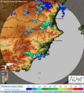
You see the set-up just before thunderstorms initiated along the mountains from northern  into eastern Spain. Most parts of the Iberian Peninsula experienced 30-40 kt NW-erly flow which caused 10-15 m/s (6 km) shear mainly over eastern Spain. Like yesterday we expected intense heating over Spain and strengthening onshore flow from the western Mediterranean which eventually would advect rich boundary layer moisture ashore along the east coast of Spain. Surface dewpoints indeed approached 20 °C along the E-coast during the noon and afternoon hours. There, many stations also reported easterly or southeasterly winds with sustained speeds of 10-15 kt. So it was not a surprise that forecast soundings and models all showed strengthening directional shear (enhanced storm relative helicity within the lowest 3 km) beyond 15 UTC over the east coast of Spain. Most models expected SRH-3 of 200 – 300 m^2/s^2 with 500 to 1000 J/kg MLCAPE, with an increase/decrease of CAPE/shear to the north. So we expected another round of mountain thunderstorm development around noon due to strong capping below 800 hPa (hence areas away from the mountains would remain capped for surface based initiation). High based thunderstorms and moderate deep layer shear all indicated a risk of a few severe downburst and large hail events. However it was thought that the main concern would arise for those storms as they would eventually move east into an increasingly more unstable and stronger sheared environment along the E/SE coast of Spain. We expected a few supercells with large to isolated very large hail, strong to isolated severe wind gusts (although cap could limit that risk) and heavy rain. In addition, rich boundary layer moisture along the coast should bring LCLs down a bit and an isolated tornado event was not ruled out. That’s why we increased probabilities to a level 2 for the east/southeast coast of Spain. For the rest of N/NE Spain a level 1 for large hail and a few severe downburst events next to heavy rain was issued. While writing this post, radar data of Spain indicates numerous intense thunderstorms with sharp reflectivity gradients and somewhat more southerly (deviant?) storm motions (compared to thunderstorms to the north) southwest of Valencia (17 UTC)….those storms are just about to enter the more volatile air mass so we’re looking forward how those thunderstorms will behave during the evening hours well into the overnight hours.


Fig.3: Radar data from AEMET @ 1640 MESZ

Fig.3: Radar data from AEMET @ 1640 MESZ

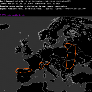
During the afternoon hours I worked with the group which prepared Day 3 and Day 4 outlooks. The Day 3 outlook will be described a bit as this day could become the more active one regarding organized thunderstorm development over at least three different regions.

Fig.4: Severe areas are highlighted with orange colours.

Fig.4: Severe areas are highlighted with orange colours.

+++++++++++++++++++++++++++++++++++++++++++++++++++

Day 3 Forecast
Valid: Fri 12 Jul 2013 06:00 to Sat 13 Jul 2013 06:00 UTC
Issued: Wed 10 Jul 2013 14:20
Forecaster: ESSL TESTBED
Severe weather is expected in:

1. Northern Spain: A Low approaching from the North, with lots of moisture and very high cape (2000-4000 J/kg) risk: some organized TS with large to very large hail and severe wind gusts.

2. Alps: Capes around 2000 J/kg,but not so much shear, so we expect only clustering storm but they can produce heavy rain, and some hail.

3. Eastern Europe influenced by a coldfront but it is uncertain where the coldfront will be located (Different models). With the coldfront moderate shear and moderate cape could produce some severe weather events.

++++++++++++++++++++++++++++++++++++++++++++++++++++++++++++

The best point to talk about : we finally expect an area with a broad CAPE/shear overlap and increasing probabilities for organized thunderstorms. As mentioned yesterday, a cut-off low over Poland will move east with a decrease in forward speed. At the same time, a cold front is forecast to push east towards Belarus and W-Ukraine. All models agree with this scenario although there are some discrepancies where to place the cold front and how fast the slow-down of the forward speed of the main upper low will be. Those points will impact our final severe risk, but today all models showed at least an overlap of 10 to 15 m/s 0-6 km shear and 500 to 1000 J/kg MLCAPE along the eastward moving cold front. We included that uncertainty by increasing the width of the severe risk area in east/west but also in north/south direction. With decreasing forcing (as the cut-off weakens and slows down) we do not expect a foreced line or a well organized MCS event but we could easily see a few multicells/isolated supercells which could produce large hail and strong to severe wind gusts. Definitively an area to look at.

The second area which was highlighted over NW/N Spain into extreme SW France will be placed ahead of a slowly SE-ward moving upper low, which starts to come ashore over NW Spain during the overnight hours. Days of persistent onshore flow and evapotranspiration beneath very steep lapse rates should cause a belt of strong to isolated extreme CAPE build-up in the order of 2000 – 3000 J/kg within the severe risk area. Shear remains wek (0-6 km bulk shear around 10 m/s), but combined with those CAPE values we would expect to see a few explosive thunderstorm developments with large to isolated very lage hail, severe downbursts and excessive rainfall amounts (due to slow storm motions). If those CAPE values continue to show up in the following model runs, we might think about that this event maybe exceeds our level 1 probabilities.

The third severe area over far NW Italy and extreme SE France just reflects the well known “500 to1000 J/kg and no shear environment”, which we already saw during the past few days. A few multicell clusters with heavy rain, isolated large hail and gusty winds likely evolve.

For Day 4 we issued a very similar map with two severe risk areas (one over N Spain and the other one over NW Italy). However we did not continue to highlight the cold front over Belarus/Ukraine as shear gradually weakens and forcing becomes very diffuse.

So to finish this post, we’re looking forward to a few active thunderstorm days during the last 2 days of the testbed week!

Share

Wed 10 July 2013, verification: The same procedure as yesterday? The same procedure as every day, James!

Chuck strived to play Cassandra’s role today: “Forget about yesterday! Today is today!” Was he convincing enough? Doubtlessly, persistence is a good companion these days.

Yesterday (Tue 9 July 2013) thunderstorms fired up over almost the same regions which we already knew from Monday, and which we would recognize again today. In the absence of other lift mechanisms, thermal upvalley and upslope circulations took over the role of trigger mechanisms for thunderstorms over virtually every mountain chain across the Southern half of Europe, where rich low-level moisture beneath still rather cool upper levels enabled moderate instability release (Fig. 1).

Fig. 1: Nowcast Display monitor at 1350 UTC Tue 9 July 2013. Rapid E-view satellite channel and lightning detections within the last 5 minutes. These data were the latest available for the 14 UTC nowcast presented in Fig. 3.

Fig. 1: Nowcast display at 1350 UTC Tue 9 July 2013: Meteosat E-view satellite image and lightning detections within the last 5 minutes. These data were the latest available for the 14 UTC nowcast presented in Fig. 3.

Compared to Monday, less severe weather seemed to have occurred over the Balkans (only one heavy rain report arrived from Croatia). The center of severe storm activity shifted more towards France, where a number of heavy rain and large hail events occurred around the Massif Central, plus a downburst which uprooted numerous trees. Furthermore, several heavy rain events with flash floods were reported across Italy.

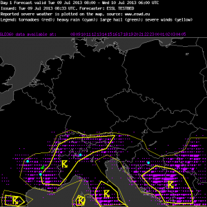
Fig. 2. Verification of the day 1 forecast valid for Tue 9 July 2013.

Fig. 2. Verification of the day 1 forecast valid for Tue 9 July 2013.

Yesterday’s day 1 forecast for the Munich domain did not include a level 1 area, hence the verification showed an “underforecasting” of these severe weather activity (Fig. 2). However, again two things need to be emphasized: (1) it is very difficult to anticipate the locations of these dispersed events associated with short-lived pulse storms, and (2) it is not necessarily a mismatch if the severe weather probability is not assumed to be above 5% within a radius of 40 km (which would match our level 1 criteria) at any given point and yet a number of severe weather events occurs, as long as they stay isolated enough. The lightning areas were well forecasted, though also with a negative bias – many areas between the 15% and 50% lightning lines actually received quite a lot of lightning.

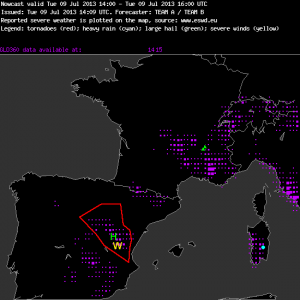
Fig. 3: Verification of the nowcast issued at 14 UTC Tue 9 July 2013, valid until 16 UTC.

Fig. 3: Verification of the nowcast issued at 14 UTC Tue 9 July 2013, valid for the 14 to 16 UTC period.

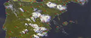
The most noteworthy change was that a weak short-wave trough moved over Spain and triggered scattered afternoon thunderstorms after a series of very hot and dry days. Northwesterly upper-level flow increased the deep-layer shear to ~15 m/s, locally even more near the East coast where opposed sea breezes developed. Hence, yesterday’s afternoon nowcasting shifted to the Toulouse domain, and a watch area was drawn in the 14 UTC nowcast (valid until 16 UTC) for Eastern Spain, where the first explosive initiation had just happened (Fig. 3). Large hail and especially severe wind gusts due to the very dry subcloud layers were thought to be the threats. No severe weather reports arrived until today, but this may also be due to the poor reporting rate in Spain. At least several healthy-looking storms occurred over the watch area (Fig. 4).

Fig. 4: Nowcast Monitor display at 16 UTC Tue 9 July 2013, the end of the validity of the nowcast shown in Fig. 3. Rapid E-view satellite channel and lightning detections within the last 5 minutes.

Fig. 4: Nowcast display at 1600 UTC Tue 9 July 2013 (the end of the validity of the nowcast shown in Fig. 3): Meteosat E-view satellite image, SYNOP reports and lightning detections within the last 5 minutes.

Today, even more storms formed over Spain, whereas not much change could be noticed elsewhere… yet. Stay tuned for today’s second post, which will outline today’s forecasts and possible changes in the near future! Our guest writer will now take over again!

Share

Tue 9 July 2013, forecasts: day 2 of the second testbed week – a short overview

It’s July, the sun shines from a cristal blue sky, people smile and everyone is happy …. everyone? Well there is a group of forecasters and scientists in Vienna Neustadt, which really looks forward to some changes in the ongoing weather pattern.  And there is indeed a silver lining on the horizon for some more organized convection for the following days over eastern Europe. However today it is Tuesday and Tuesday still had a huge surface high pressure area over a big part of western and central Europe, so no major changes were yet seen.

The figure below should offer you a short overview about the conditions on our second testbed day:

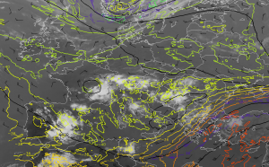
Fig.1 IR 10.8 and 300 hPa winds (barbs), heights (lines) and temperatures (colored lines)

Fig.1: IR 10.8 satellite and 300 hPa winds (barbs), heights (lines) and temperatures (colored lines)

Group 1 forecast for Tuesday (Day 1): The dominant high pressure area which extended from Spain all the way to the UK continued its gradual weakening trend and left behind a broad area with fairly weak height gradients at 500 to 300 hPa. In this figure you can still see the broad cyclonic circulation which meanders over Italy and the Adriatic Sea. Filled with cool mid-level air atop hot and humid lower levels set the stage for another round of active thunderstorm development over an extensive area. This includes most of Italy, Corsica, Sardegna and the Balkan States. In addition you can see another cyclonic vortex over S-France which likely assisted in thunderstorm development from SE France into Switzerland. Like it was the case during the past few days, shear at all levels was forecast to stay weak with 0-6 km bulk shear remaining below 10 m/s during the forecast. However we noticed a gradual increase in boundary layer moisture and hence also an increase in expected CAPE build up with models pointing to local peaks well in excess of 1500 J/kg mainly over SE France. We once again issued our 50-% lightning areas along the mountain ranges, surrounded by a broad 15-% lightning area which was very similar to Monday. However, during the day today we received some worrisome reports of heavy rain and very intense wind gusts with Monday’s convection (e.g. a wind gust of 35 m/s over southeastern France (not yet verified) and some flooding problems in the western Balkan States [see http://www.essl.org//cgi-bin/eswd/eswd.cgi ]) so we are afraid that we might have underestimated the risk for Tuesday in our DAY 1 forecast. We might end up seeing level 1 conditions from the Massif Central to the east but also over parts of the Balkan States as those thunderstorms really had healthy looking updrafts (overshooting tops) and even better CAPE to work with compared to Monday. We will see in tomorrow’s verification how our reluctant forecast without any level 1 areas worked out.  Another area we were concerned about evolved over northeastern Spain, where onshore flow advected better moisture well ashore. All models showed some more or less aggressive signals for initiation with high based (severe downburst prducing) thunderstorms and fat mid-level CAPE profiles (isolated large hail). However we were unsure about the final magnitude of initiation due to ongoing capping issues, so we decided the stay with the safe forecast and issued our Day 1 forecast once again for the Munich domain (e.g. from Italy to S-Germany into the Balkan States).

Group 2, forecasting for day 2:

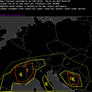
DAy 2 outlook with yellow lines representing the thunderstorm areas (15-% thin lines and 50-% thick lines) and orange lines showing the level 1 areas.

Fig.2: DAy 2 outlook with yellow lines representing the thunderstorm areas (15-% thin lines and 50-% thick lines) and orange lines showing the level 1 areas.

I don’t want to spend too many words on tomorrow’s outlook (for Wednesday) as no serious change in the weather pattern is forecast. However this group increased probabilities and issued two level 1 areas, given once again improving boundary layer moisture forecasts (with modest mid-level lapse rates atop also increasing CAPE forecasts).

##################################################

Day 2 Forecast
Valid: Wed 10 Jul 2013 06:00 to Thu 11 Jul 2013 06:00 UTC
Issued: Tue 09 Jul 2013 08:27
Forecaster: ESSL TESTBED
Group: MAP Room

Balcan Area: expect strong wind, heavy rain ,small hail, some instabilty,
Pulse severe events, poorly organised

Alps and southern France (incl. massiv central):
on the border of moist and hot air on south and dry on north, around Alps, France and Pyrenees (Border between France and Spain). Poorly organised pulse storms.
Expect heavy rain, strong wind and small hail

Italy:
Poorly organised pulse storms

expect localy heavy rain, localy strong wind gusts

###################################################

During the afternoon hours we once again split up into two groups, one watching the nowcast for watch issuance and the other group preparing outlooks for Day 3 to 5. In the nowcast group the focus for watch issuance shifted to northeastern Spain due to the severe downburst, isolated large hail and locally heavy rainfall risk. In addition we already had initiation over the mounatins in Italy, the Massif Central, the Alps and the Balkan States. I added a RapidSandwich product of 1830 UTC from Spain:

Fig. 3: Rapid Sandwich product, showing the cloud top temperatures at 1830 UTC for Spain and Portugal.

Fig. 3: Rapid Sandwich product, showing the cloud top temperatures at 1830 UTC for Spain and Portugal. Wind barbs show 300 hPa wind speed.

The thunderstorms developed along the mountains and remained there for one to two hours before moving slowly off to the east. You can see somewhat stronger 300 hPa winds over Spain and we had 10 to 15 m/s of deep layer shear (6 km bulk shear) mainly over southeast into eastern Spain. Therefore we expected a few better organized multicells and we’re eagerly looking forward to see some reports tomorrow in the ESWD.

The other group prepared the Day 3 to Day 5 outlooks and I will show the DAY 4 outlook to also describe the others:

Fig.4: Orange lines showing where some enhanced probabilities for severe thunderstorms are forecast.

Fig.4: Orange lines showing where some enhanced probabilities for severe thunderstorms are forecast.

On all three days we we see ongoing pulsating and mainly daytime driven thunderstorm development over parts of northern and eastern Spain, south France, Italy and the Alps into the Balkan States. We probably continue to issue level 1 areas for this activity, where highest CAPE and thunderstorm coverage is anticipated. However you can also see a severe risk area over Belarus into the Ukraine. A trough from Norway and Sweden moves south on Wednesday and closes off over Poland during Thursday and Friday. This feature will add some overlap of shear and CAPE, so we finally expect also more organized thunderstorm development during the following days of our testbed week mainly from Poland to the south and east. We’re surley looking forward for this change!

Share

Tue 9 July 2013, verification: F1 downbursts out of the blue yesterday

By the time of writing, 21 severe weather reports have arrived for yesterday’s (Mon 8 July 2013) pulse storm activity over the mountain areas across the Southern half of Europe. Our Bosnian Testbed participant Milica deserves special credits for retrieving and entering a few of them into ESWD on-site when we prepared today’s opening verification session.

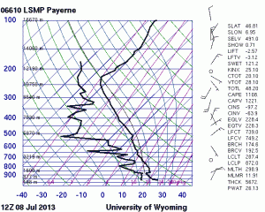
The most striking reports were at least three wind events in Serbia which uprooted trees and damaged house roofs, pointing to maximum wind speeds in the lower F1 range (i.e., between 120 and 150 km/h). Later today, another report arrived from France with a measured wind gust of 38 m/s (135 km/h) at Croix de Chamrousse yesterday. While we were still discussing whether evaporative cooling and/or precipitation load could indeed cause such extreme wind gusts in the absence of almost any vertical wind shear (see the 12 UTC Payerne proximity sounding in Fig. 1a), a closer look at the station’s graphs which were included in the primary source of the ESWD report revealed that it is rather doubtful: the extreme gust did neither plausibly fit to the mean wind (only 4 m/s) nor to the temperature, which remained constant during the alleged wind gust and only dropped some time later, when the station was indeed hit by a thunderstorm. A more thorough review of this event is on the way, but a data error seems more likely than a true measurement.

Fig. 1a.

Fig. 1a.

Fig. 1b.

Fig. 1b.

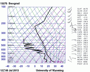
However, the Serbian wind events were impressive enough, given that the Belgrade proximity sounding looked equally inconspicuous (Fig. 1b). Additionally, reports of marginally severe hail events arrived from Serbia, the Swiss and French Alps and the Italian West coast, and reports of excessive rainfall from Serbia, Bosnia-Hercegovina and Croatia (Fig. 2).

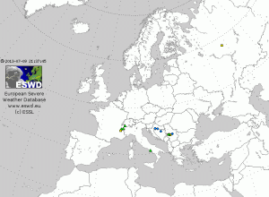
Fig. 2: ESWD reports (yellow: severe wind, green: large hail, blue: excessive rain) between 06 UTC Mon 8 July and 06 UTC Tue 9 July 2013.

Fig. 2: ESWD reports (yellow: severe wind, green: large hail, blue: excessive rain) between 06 UTC Mon 8 July and 06 UTC Tue 9 July 2013.

Altogether, the number of severe weather events was higher than we expected on such a seemingly quiescent day. It was a gentle reminder that even though heavy rain is the dominant and obvious risk with storms on such days, at least localized events of marginally large hail and severe downbursts should not be left unconsidered. Maybe a level 1 is appropriate for regions with a more robust instability release even in the absence of noteworthy vertical wind shear.

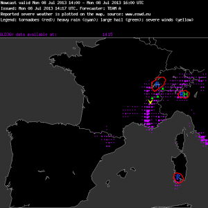
Fig. 4: Verification of the nowcast issued at 14 UTC Mon 8 July 2013, valid for the 14 to 16 UTC period.

It is needles to say that forecasting, and even more nowcasting, of such storms is particularly difficult. Fig. 3 shows yesterday’s 14 UTC nowcast (valid for 14 to 16 UTC) for the Munich domain, which did not verify positively at all. Three different areas were covered with rain watches, where either young and healthy-looking storms were already present or new daughter cells seemed about to initiate. The storm over the Italian Alps was the only one for which an additional hail threat was mentioned, since it seemed to be close enough to ingest the best low-level moisture over the Po Valley, allowing the strongest instability release. However, within the following two hours hail was reported from the French and Swiss Alps instead, while the “shadowed” storms started to decay rather soon. Fig. 4 tries to illustrate how difficult it is to do nowcasting for such a mosaic of “popcorn storms”: which of the dozens of unorganized storms will be the next big thing?

Fig. 4: Nowcast Monitor display at 1530 UTC 8 July 2013: E-view satellite image and CERAD radar composite.

Fig. 4: Nowcast display at 1530 UTC 8 July 2013: Meteosat E-view satellite image and EuRadCom radar composite.

A more thorough weather discussion will follow in a separate post by this week’s newly acquired guest writer. 😉

Share