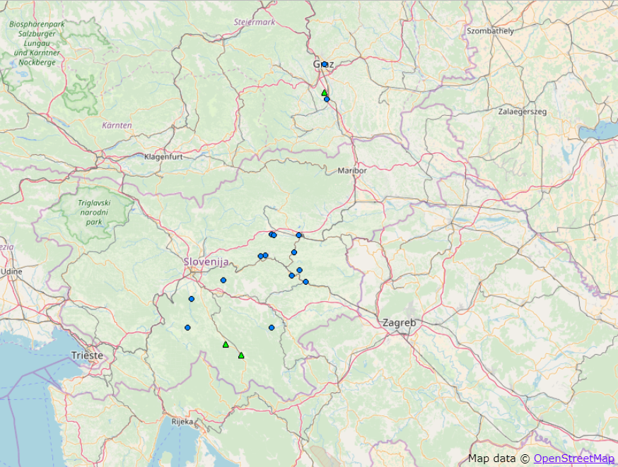
Fig. 1 Severe weather reports collected for 14 April 2018 across Slovenia and southeastern Austria. Blue circles denote heavy rainfall reports and green triangles large hail reports.
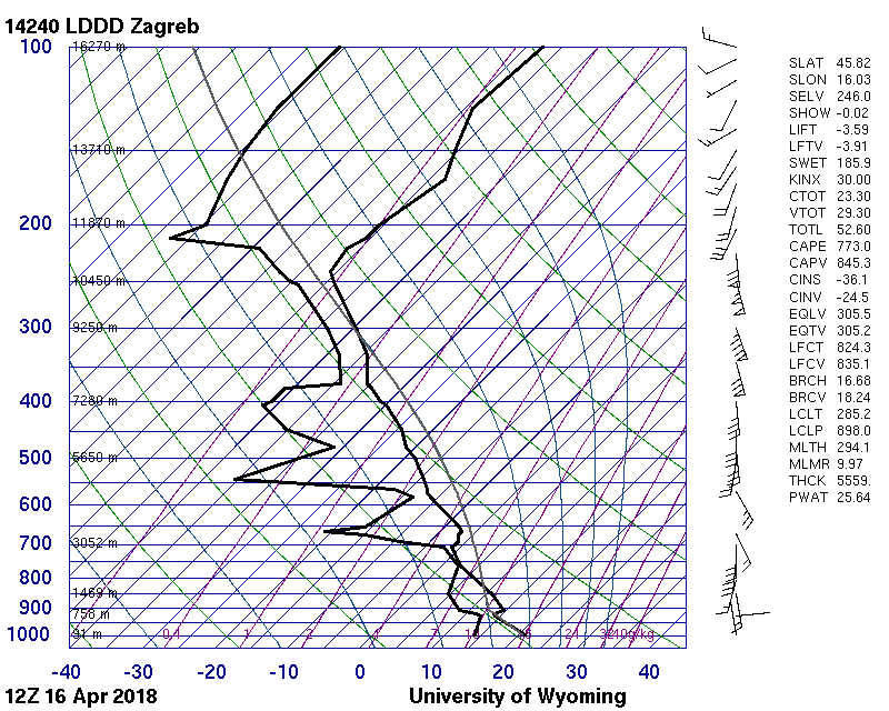
Anticipating situations conducive to flash flooding may be quite tricky, as it often takes a quasi-stationary, long-lived thunderstorm to deliver several waves of heavy rainfall over an area. Yesterday was no exception. Thunderstorms formed in an environment featuring moist, southeasterly flow at the surface, CAPE values on the order of several hundred J/kg and an increasing southerly flow aloft (Fig. 2). A very moist profile in low to mid troposphere along with low cloud bases was evident, both from the forecast sounding over southeastern Austria and from the observed sounding in Zagreb, Croatia (Fig. 3). These conditions suggested a potential for very heavy rainfall with thunderstorms as little precipitation would evaporate when falling from the cloud.
Fig. 2 A 15 UTC forecast ICON-EU forecast of 10 m wind (arrows) and 2 m dew-point (colours), initialized at 00 UTC. Forecast sounding was taken at the location marked by red star.
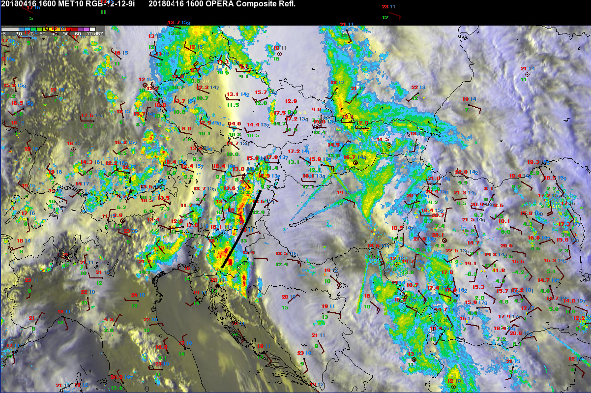
Even so, the increasingly southerly flow aloft meant that thunderstorms could hardly stay confined to one location and would move northward with time. Yet, that has not happened, as one can see from this radar animation shared by ZAMG, which reveals a number of instances of storms stagnating over one particular location. This is because storms were propagating (propagation represents the movement of the thunderstorm caused by the formation of new cells) along the convergence zone towards the moister and more unstable airmass in the south. With a mid- to upper-tropospheric flow almost parallel to the convergence zone and the propagation cancelling out the advection of individual cells to the north by mean wind, some of the thunderstorm clusters became quasi-stationary and produced excessive rainfall.

Fig. 4 16:00 UTC satellite (combination of visible and infrared channels) and radar (OPERA composite) imagery. 2m temperature (red numbers), 2 m dewpoint (green numbers) and 10 m wind (barbs) are plotted for individual stations. Thick black line denotes the approximate location of convergence zone. OPERA radar data © EUMETNET, satellite data © EUMETSAT.
This case shows how demanding it can be to correctly anticipate flash flood situations with thunderstorms when numerical models underestimate the rainfall sums, which is often the case with convective phenomena.

